Showing posts with label Douglas County. Show all posts

Friday, March 10, 2017

First Bike Ride 2017 On Spruce Meadows Trail

First 2017 ride on my 2003 bicycle, still going...somewhat
This week was my first 2017 bike ride, not counting the 1.2 miler I did last week after adjusting my mountain bike after a couple years of neglect.  Not that it was finished or anything, as I found out after starting my ride on Spruce Meadows Trail, an 8.6 mile fairly easy pedal through the Greenland Open Space area, where cattle still grazes on specific plots for weeks each summer.
By the way, this area is one of the widest-open spaces in Colorado, where you can see for miles in most directions and get a real feeling for what "Open Space" really is.

Snow covered Pikes Peak, Spruce Mountain to the right
The first leg is an easy pedal 1.9 miles to the southwest, going toward Spruce Mountain.  Pikes Peak glistens with snow ahead, Spruce Mountain rises to my right.  The trail passes 2 ponds along the way, and winds around some drainage's.  The elevation increases 200 feet in this 1.9 miles, but is not difficult unless you are new to bicycling at 6800-7000 feet elevation.  After traversing the property, I crossed under Spruce Mountain Road in a large culvert made for this, and climbed the hill on the south side of the road.

Colorado often uses culverts like this for trails
Here is where I experienced derailleur problems where the gears kept shifting on their own, causing me to loose traction on the hill.  I got off and pushed my bike up to the picnic table beside the Spruce Mountain Trail where I often hike.  By balancing the bicycle frame on the table seat edge, I was able to loosen the tension on the rear derailleur cable to fix the self-shifting problem while changing gears and spinning the wheel.  Then I enjoyed a snack and watered-up.  The wind here was gusting in the mid-30's, and it was a cool 60 degrees if you were not pedaling.
17 years of riding this bicycle and some parts are now worn out.  I keep nursing the bike along until I can replace it.  The derailleurs, shifters and rear cogs may be next.  I bought it in Castle Rock in the early spring of 2004 (a 2003 model) and mostly rode it off-road and on bike trails locally, then mostly paved trails since 2010 when I upgraded the tires, hand grips, chain and added the rear rack.  I like the way the bike fits me, and the way it is geared.  I hope I can make it last a for few more years of easy bicycling.

Spruce Mountain ramparts...
Continuing to the right...
From here, I rode past the Spruce Mountain Trailhead and north up the meadow and past another pond toward Eagle Pass. It was hard enough riding uphill into the wind, but when I passed the cutoff trail, the wind was now blowing from my left, causing me to pitch over to the right, often catching my pedal on the rough and rutted trail.  I finally took my feet out of the toe clips so I could dab the ground to prevent falling while pedaling occasionally on the downhill leg.  The entire Front Range opens to my left, the town of Larkspur is straight ahead with Rattlesnake Butte on the left across I-25. It was a long 1.6 miles of dabbing grassland to Noe Road.  As I neared Noe Road, I got off and walked the bike the last few yards.

From the top of Eagle Pass, looking north toward the town of Larkspur
Noe Road is named for a pioneer farmer/rancher who lived in this area way back when the Native Americans caused serious problems for the settlers.  It is a dirt road, coated with what I call "Dipity-Doo" to keep the dust down, worth every penny in wind like we are having today.  Here I could continue along the trail with another 5+ miles of toe-dabbing through the meadows, or follow Noe Road 1.5 miles back to my car with the wind at my back.  I opted for the wind at my back and pedaled back to my car with no gear problems.

Looking back south to Eagle Pass
The trail is within 20 miles of my home, and I plan to come back when the wind is not as strong, and ride the whole loop at one go.  That may be a couple to three weeks from now as the weather is turning colder and some March snow is forecast.  My experience with these meadows is that a little moisture turns it all into a quagmire for a couple days, until the sun and wind dries it out again.

Trail Sign at Noe Road
To find Spruce Meadows Trail, south of Castle Rock exit I-25 at #167, turn west, bypass the Greenland Open Space Park, unless you need to walk your pet or get drinking water, carefully cross both railroad tracks and turn left into the Spruce Meadows Trailhead parking lot.
If you want to hike or bicycle a mountain instead, continue west to Spruce Mountain Road, turn left (south) and follow less than a mile to the first right, and turn into the Spruce Mountain Trail parking area.

Trail north of Noe Road, lots more grass, Rattlesnake Butte on right


Friday, February 19, 2016

Natural Surface Trails in Castle Rock and Douglas County, Colorado


For the snowshoeing and cross-country skiing crowd in Colorado, there are many local trails in and around Castle Rock that are natural surface and are not cleared of snow during the winter. These trails include some that are nestled in deep woodlands and others that are in an urban environment. For many, just a chance to get out in the snow without having to drive into the mountains is a relief.
In Castle Rock these natural surface trails include:
Gateway Mesa
Hidden Mesa plus the interconnect trail to the paved Cherry Creek Trail
Crystal Valley/Rhyolite Fitness Trail
The Rock Trail is the climb up Castle Rock
Memmen Ridge Open Space
Just out of town you can add:
Dawson Butte Open Space Trail
Spruce Mountain Trail
Spruce Meadows Trail
Lincoln Butte Open Space Trails
Many more Douglas County Colorado Open Space trails are listed HERE, most are unpaved.
Please enjoy yourself during the winter months, dress warmly, carry the 10 Essentials, and drink plenty of water to stay hydrated. Check my Winter Hiking Prep Blog here.

Friday, July 17, 2015

Lincoln Mountain Open Space Trail

Lincoln Mountain Open Space Trailhead Parking
Lincoln Mountain Open Space Trail sits about 18 miles south of Franktown just west of CO 83. From the parking area, the Lincoln Mountain Trail loop climbs almost 400 feet up the mesa with views in all directions, and runs 4.2 miles.  The Palmer Divide Ranch Trail runs 4.5 miles through lower elevations and loops along west Cherry Creek through meadows.  The trail is multi-use so expect hikers, mountain bikers and horseback riders along the way.  A map is available HERE.

Trail Junction
Easy climb through a flowered meadow
The climb gets steeper once you get in the scrub oak
Flowers are all along the trail
The trail continues to the left of the first junction and crosses a runoff ditch that feeds a pond, then moves into scrub before climbing steeply up in switchbacks across a drainage.  There are 3-4 places where the area had been very muddy when horses last came through, and dug some holes in the trail. Please allow the trail to dry a little or you will get bogged down after a heavy rain.  You will zig here and zag there as you climb, a walking stick is helpful.  You will know the steepest part is over when you pass a bench on your right with lots of views.

Drainage wall at pond
Beware when the trail is wet and muddy
Trail climbs to the top
View below
Trailhead view from near the top
Loop sign on Lincoln Mountain top
The trail then climbs to the loop portion along the side of Lincoln Mountain for about one half a mile. Once I reached the loop at the mesa top, I was greeted with the elevation of 7,394 ft etched into the sign (West Cherry Creek where you cross over on the bridge at the entrance is at 7000 feet elevation). I turned right for a counter-clockwise circumference of the mesa meadow top.

East
North
South
West
And the views were awesome in all directions. Eastward, you could see hill tops almost to Elizabeth. Looking North you could follow the mountains along the front range until they disappeared.  West you could see the mesas between Lincoln Mountain and the Front Range.  And to the South you could see from Pikes Peak to the Black Forest. Ranches and homes looked like tiny toys in the fields below.  An experimental airplane motored above, a white triangle against the rich blue sky.  A hawk flew from the ground to circle above me.  A moth kept following me, lighting on my hiking pole repeatedly as I walked.  It was very nice and was almost silent.

Mothed!


Grandelion!

The trail along the mountain top was littered with small rocks.  I noticed small white quartz stones all along the trail, even when going down through the meadow.  The field atop the mesa was awash in blooms with almost every flower present blooming.  Orange Indian Paintbrush, white Yucca, yellow cactus, reds, purples, whites and yellows of every imaginable shade.  A botanist's dream.

Back of the top of mountain trail sign
Crossing through the old fence
Hiking down the mountain
I circled Lincoln Mesa and turned back downhill, passing through the old fence posts.  Once at the bottom, I turned to the Palmer Divide Ranch Trail, but gave up when I noticed the time.  I'll hike this trail soon.

Bench at Dewey's Hill on the Palmer Divide Ranch Trail Loop
To get there, follow CO 83 south 18 miles from Franktown.  Turn right on Jones Road, County Road 80, follow the gravel road to cross West Cherry Creek and take the second right into the parking lot. The approach trail runs .2 miles to where it splits for Lincoln Mountain and Palmer Divide Ranch loops.  Bring your drinking water, wear sunscreen and insect repellent.

Friday, April 17, 2015

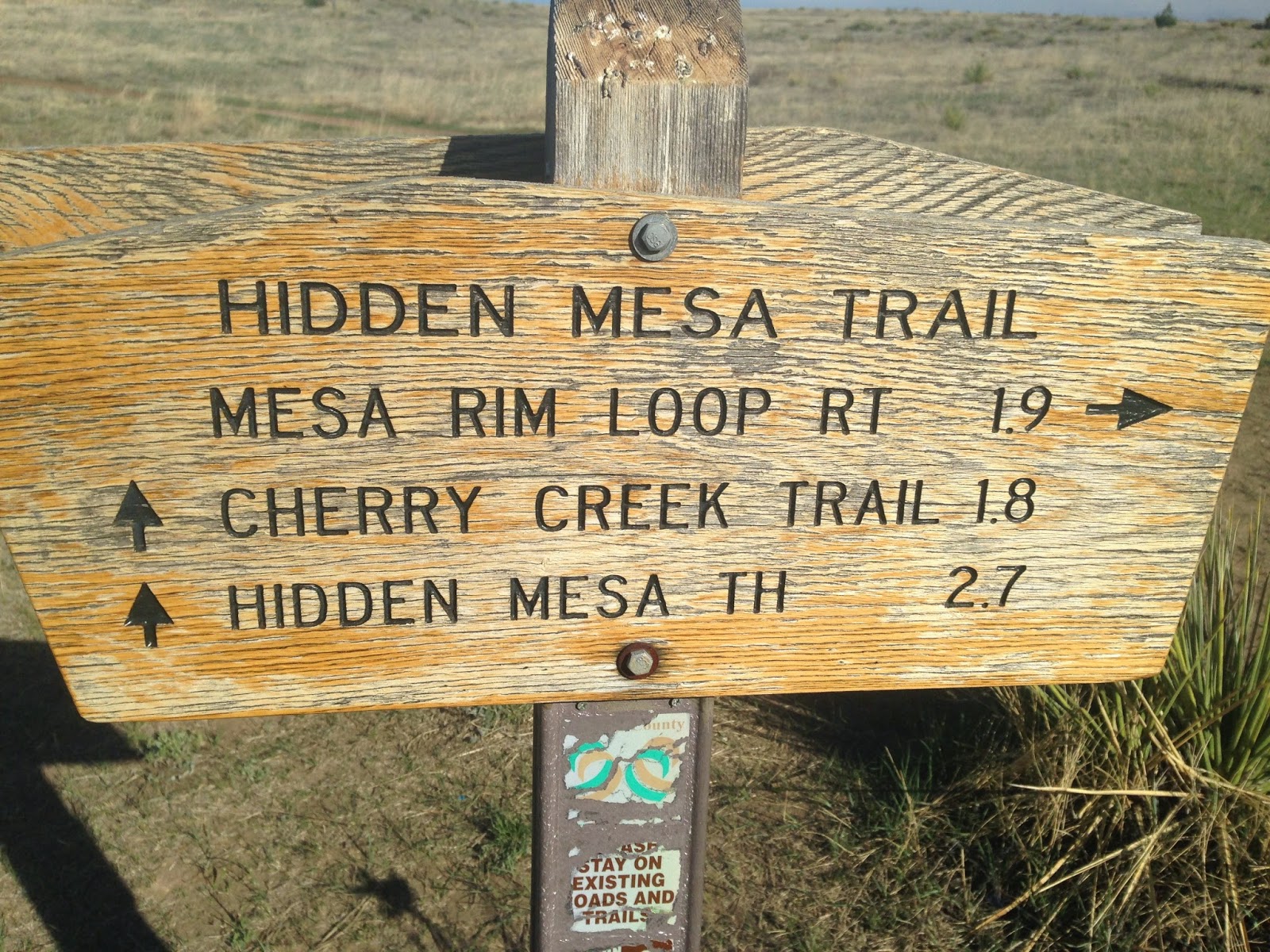
Hidden Mesa Trail - The Mesa Top

Top of the mesa trail sign
I hiked the Hidden Mesa Open Space Trail along the mesa top 3 times in the past 2 weeks because it is so QUIET. The 2 mile loop trail, just a third of a mile from the parking lot, is an easy, mostly flat hike with views in all 4 directions.  My wife joined me for each of these hikes.  A map is available at the link also.

Looking North East
The peacefulness is just plain inspiring.  Bird song was the second loudest noise I heard.  Prairie Dog warnings were the loudest noise by far.  Even the occasional whoosh of an airplane above was washed away by the wind and that wind was heard through the trees.
I last wrote about the Hidden Mesa Trail here, when I walked a portion of the lower trail off CO 83 at Franktown.  I still have to walk the trail from there up to the mesa top and will write about that when it happens.
Looking East
The trail is well marked
Most of the walk is in the sandy top soil of the mesa.  This sand is from the worn down crust of the top layer of Rhyolite, and is filled with quartz and black, brown and red river stones that came with the Rhyolite.  You can read about how this form of Rhyolite came to be here.

Rhyolite in its interesting hoodoos
As you travel counter-clockwise from the parking lot junction, you travel mostly on rock with short sandy areas in between.  Conifer trees sprout from the stone along the path and provide moments of shade and add sound to the wind whistling through them.  Oak scrub grows mostly from the soil and away from the cliff edge.  You can see highway 86 below you beyond the tumble of rocks and occasionally hear traffic on it.  The trail continues around the edge, then works back northerly onto the mesa center before running to the edge twice more.

Looking Southeast
Now on the eastern side of the mesa, the views are of Cherry Creek below, the farms and Franktown. Below is the 124 acre test farm, greenhouse and orchard next to the old family house of the original farm and acreage that Douglas County Open Space purchased as part of Hidden Mesa.  The picnic area and parking lot are next to that, with the farm lane winding down to cross Cherry Creek and then picking up the Cherry Creek Trail going north and south.  A couple benches up here provide views to the east and provide a break in your day.

Early spring flowers
A lot of old trash has washed on down the mesa to the right.  Behind the oak scrub there is an old refrigerator, a furnace and half an acre of rusting tin cans.  My hope is someday they will remove this trash, recycle what they can and bury the rest.  The mesa top deserves that.

Natural surface trail
Showing the route and distance to the Trailhead on CO 83 below
 The trail continues on, turning to the left before its junction with the trail to the farmland below. Prairie dogs squeak here, warning others of the danger.  It is fun to watch them run from hole to hole, pop up and down and suddenly go quiet when you get too close.  A couple holes are right next to the trail and I expect these prairie dogs are very busy sounding the alarm on weekends.

It is nice to have signs as nice as this one

Bench for relaxing
A mountain biker whizzes by after announcing his presence, then thanks us for stepping off the trail to let him pass.  Nice trail etiquette! This trail is quite popular with the mountain bikers.  It has some technical challenges mostly along the rock edges, and gives a good climb up the ridge, but it is not too technical for novice riders.  Plus it is close to Castle Rock, Franktown and Parker.

Rhyolite near the edge
Mostly in the open now, we look to the north and follow the view of the mountains of the front range until they fade in the distance.  We climb a hill and drop down a little to the parking lot trail by the bench.  Returning to the car is fairly quick, with just a short drop and a few turns along an old farm road.
More spring flowers
The gate here closes automatically at dark.  We sit and talk a while listening to the wind, and finally leave as another mountain biker pulls in.  It has been a peaceful afternoon.

Parking lot for Hidden Mesa
Getting here is easy.  Take I-25 south of Denver to exit 184 at Founders Parkway, then follow to the left through the stores 2 miles to the Terrain Subdivision on the east side of the road.  Turn left into the second entrance which is Rising Sun Drive, follow left through a roundabout to Autumn Sage Street, then turn left onto Castle Oaks Drive.  This takes you downhill by the remains of an old farm, and crosses a stream.  Then take the second gravel road right onto Pleasant View.  Follow this to the top where the parking area is, park and hike.  There is a Port-a-let at the end of the parking lot.