Showing posts with label Colorado. Show all posts

Friday, March 10, 2017

First Bike Ride 2017 On Spruce Meadows Trail

First 2017 ride on my 2003 bicycle, still going...somewhat
This week was my first 2017 bike ride, not counting the 1.2 miler I did last week after adjusting my mountain bike after a couple years of neglect.  Not that it was finished or anything, as I found out after starting my ride on Spruce Meadows Trail, an 8.6 mile fairly easy pedal through the Greenland Open Space area, where cattle still grazes on specific plots for weeks each summer.
By the way, this area is one of the widest-open spaces in Colorado, where you can see for miles in most directions and get a real feeling for what "Open Space" really is.

Snow covered Pikes Peak, Spruce Mountain to the right
The first leg is an easy pedal 1.9 miles to the southwest, going toward Spruce Mountain.  Pikes Peak glistens with snow ahead, Spruce Mountain rises to my right.  The trail passes 2 ponds along the way, and winds around some drainage's.  The elevation increases 200 feet in this 1.9 miles, but is not difficult unless you are new to bicycling at 6800-7000 feet elevation.  After traversing the property, I crossed under Spruce Mountain Road in a large culvert made for this, and climbed the hill on the south side of the road.

Colorado often uses culverts like this for trails
Here is where I experienced derailleur problems where the gears kept shifting on their own, causing me to loose traction on the hill.  I got off and pushed my bike up to the picnic table beside the Spruce Mountain Trail where I often hike.  By balancing the bicycle frame on the table seat edge, I was able to loosen the tension on the rear derailleur cable to fix the self-shifting problem while changing gears and spinning the wheel.  Then I enjoyed a snack and watered-up.  The wind here was gusting in the mid-30's, and it was a cool 60 degrees if you were not pedaling.
17 years of riding this bicycle and some parts are now worn out.  I keep nursing the bike along until I can replace it.  The derailleurs, shifters and rear cogs may be next.  I bought it in Castle Rock in the early spring of 2004 (a 2003 model) and mostly rode it off-road and on bike trails locally, then mostly paved trails since 2010 when I upgraded the tires, hand grips, chain and added the rear rack.  I like the way the bike fits me, and the way it is geared.  I hope I can make it last a for few more years of easy bicycling.

Spruce Mountain ramparts...
Continuing to the right...
From here, I rode past the Spruce Mountain Trailhead and north up the meadow and past another pond toward Eagle Pass. It was hard enough riding uphill into the wind, but when I passed the cutoff trail, the wind was now blowing from my left, causing me to pitch over to the right, often catching my pedal on the rough and rutted trail.  I finally took my feet out of the toe clips so I could dab the ground to prevent falling while pedaling occasionally on the downhill leg.  The entire Front Range opens to my left, the town of Larkspur is straight ahead with Rattlesnake Butte on the left across I-25. It was a long 1.6 miles of dabbing grassland to Noe Road.  As I neared Noe Road, I got off and walked the bike the last few yards.

From the top of Eagle Pass, looking north toward the town of Larkspur
Noe Road is named for a pioneer farmer/rancher who lived in this area way back when the Native Americans caused serious problems for the settlers.  It is a dirt road, coated with what I call "Dipity-Doo" to keep the dust down, worth every penny in wind like we are having today.  Here I could continue along the trail with another 5+ miles of toe-dabbing through the meadows, or follow Noe Road 1.5 miles back to my car with the wind at my back.  I opted for the wind at my back and pedaled back to my car with no gear problems.

Looking back south to Eagle Pass
The trail is within 20 miles of my home, and I plan to come back when the wind is not as strong, and ride the whole loop at one go.  That may be a couple to three weeks from now as the weather is turning colder and some March snow is forecast.  My experience with these meadows is that a little moisture turns it all into a quagmire for a couple days, until the sun and wind dries it out again.

Trail Sign at Noe Road
To find Spruce Meadows Trail, south of Castle Rock exit I-25 at #167, turn west, bypass the Greenland Open Space Park, unless you need to walk your pet or get drinking water, carefully cross both railroad tracks and turn left into the Spruce Meadows Trailhead parking lot.
If you want to hike or bicycle a mountain instead, continue west to Spruce Mountain Road, turn left (south) and follow less than a mile to the first right, and turn into the Spruce Mountain Trail parking area.

Trail north of Noe Road, lots more grass, Rattlesnake Butte on right


Friday, May 6, 2016

Road Trip - Ludlow Massacre Site


My Road Trip continues from Sand Creek Massacre National Historic Site to the Ludlow Massacre Monument.
On April 20th, 1914, Ludlow, Colorado was the site of the Great Coalfield War. With the coal miners on strike for better conditions and the United Mine Workers not yet able to organize them, the coal companies had begun taking pot shots at the miners and families living in their tent cities in an attempt to get them back to work. No one knows who fired the first shots that led to the Ludlow Massacre, but machine gun and rifle fire forced women and children to take refuge below ground where they had dug a pit beneath their tents. Fires broke out in the tent city. By early the next morning, the colony that was once covered with hundreds of tents was now charred rubble. The bodies of two women and 11 children were found huddled beneath one of the burned tents, victims of asphyxiation. In addition, nine other men on both sides and two youngsters were found dead.  The death toll continued for days after in other camps, until Federal Troops moved in to restore order. The strike ended without resolution in December of the same year.
Being a coal miner was a hard, short life. Mostly they lived in squalor, the miners here were paid in company script, not cash. That made them spend the script in high-priced company stores, forced to pay the high rent for company housing.
In 1918, the stone monument was built on the site by the UMW, the town was deserted in the 1950's and the Ludlow site was added to the National Historic Register in 1986. Today, you can walk down a flight of steps into the pit below ground, where I assume, the 13 bodies were found. There is the nice UMW monument here and today, which happens to be the 102nd Anniversary of the Massacre, someone had left flowers on the monument in remembrance. Read the signage outside the fence for more facts about the area.
Otherwise the site is fenced with picnic tables under a roof, there is an old coal car, and a large, empty parking lot. The tent city once covered about 40 acres of the emptiness here. Most of the remains of the community of 1,000 people are now gone.
You can find the town of Ludlow along I-25, 15 miles north of Trinidad at exit 27.
My Road Trip had began today from Trinidad. After a quick visit to the Trinidad Visitor Center temporary office near the Bloom Mansion, it was just a 20 minute drive to Ludlow.  Then I was back on I-25 driving south to Trinidad to begin the Highway of Legends, a loop around the Spanish Peaks on highway 12 and US 160 to Walsenburg, and back north on I-25 to Castle Rock. You can read about the Highway of Legends HERE. I don't typically go visiting massacre sites, but this trip seemed to speak to me, especially in these modern times where life is mostly good. It is a good time to look back and be thankful for what we do have, and to remember those who were often violently taken from us for something we cannot even comprehend today.

Friday, April 29, 2016

Road Trip - Sand Creek Massacre National Historic Site

Sand Creek Massacre National Historic Site.
My drive east across the Colorado prairie was detoured by a late spring snow, so I drove south first to Pueblo, then went out east across the Big Empty. There was no snow along this route. There also wasn't much else to look at, except for a few small communities marked by grain elevators. This was a very long Road Trip across almost featureless plains.
I did stop along the road to shoot a few photos and I have included those below.
The Sand Creek Massacre National Historic Site is located along Sand Creek, which was also called Big Sandy and during the mid-1800's was part of an Indian trail into the region.
The ranger on duty told me "this site commemorates a national tragedy". Please read about the massacre HERE. There are many sites online, books, films and TV stories about the event. Living in Colorado, you become aware of the Sand Creek Massacre very quickly. Please click PLAY on the short video below.


The flag you see in the at the start of the video, is a 33 star flag, similar to the one Black Kettle flew from his tee pee with a flag of truce that fateful morning of November, 28th 1864. What I found there and tried to show in my short video, was peace. And quiet. Birds were the only sound I heard at the site other than wind.  The few others who visited while I was there were thoughtful, respectful and quiet too. I feel it is important to remember these terrible events, the times that are not shiny and clean. Maybe by remembering them we can choose to not repeat them.
From my road trip (almost to Kansas) here are some photos from along the route.

Rusted Railroad Fuel Container along Highway 96 East

Once-nice abandoned home along Highway 96

One of many cool old buildings in Ordway, CO

Cannot refuse an old street sign in Ordway, CO

Star of Sugar City, CO
I continued driving south along back roads to La Junta, CO, then followed the Santa Fe Trail route to Trinidad, CO where I spent the night.
So far my Road Trip began in Castle Rock, followed I-25 south through Colorado Springs (where I last saw snow) to Pueblo. There I turned east onto highway 50, then left onto highway 96 east. At Eads, you pick up US 287 for a couple miles, then turn left onto 96 east again. Follow this to Chivington and turn left onto county road (dirt) 54. Follow this road north until you hit a T stop, turn right, then left into the National Historic site.
When leaving, return to 96 and follow it west through Eads to Colorado Highway 31, then left/south to Cheraw. Pickup highway 109 at Cheraw and follow south to La Junta. Go west on highway 50 and then go south on US Highway 350, and follow the Santa Fe Trail to Trinidad. A long, full day Road Trip! More Road Trip to come!


Friday, April 22, 2016

Road Trip - Highway of Legends

Highway of Legends!
Colorado's Scenic Byways always take you somewhere really cool and unusual! This route, the Highway of Legends, loops around the two Spanish Peaks which tower over the region. I drove from Trinidad in south Colorado clockwise around these mountains to Walsenburg, following Colorado Highway 12 and US 160.  West Spanish peak has an elevation of 13,626 feet with the East Spanish Peak topping out at 12,683 feet.  The 17, 855 acre Spanish Peaks Wilderness Area includes both summits and offers great hiking and backpacking opportunities. Click HERE for more of the legends and stories about the area. Geologic information about the spectacular dikes formed in the region are available HERE.
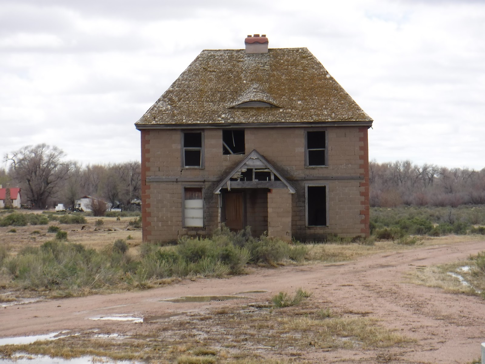
The first part of the loop, starting outside of Trinidad was very much like driving through Appalachia with visible seams of coal in the roadside cuts and oppressive poverty with abandoned buildings and junked cars providing homes for weeds in the unkempt yards. There was much poverty here, with much money in the land up and away from the road, funding weekend farms and get away cabins just up the mountain behind them.

Welcome to Cokedale
After passing the entrances for the Trinidad Lake State Park, you arrive at Cokedale, surrounded with man-made mountains of slag and the old coke oven structures. Over 140 people now live here full time in the towns historic mining houses, the community was placed on the National Historic Register in 1984. The American Smelting and Refining Company had sold the land and homes to the miners at reduced prices.
A quick drive takes you through Cokedale's community neighborhoods, by the old school house, and around the old miner's office and the (privately owned) Gottlieb Mercantile Company.  This was once a model mining community with a population of 1500 in 1909. Founded in 1906, it operated over 40 years to when the company sold out in 1947 due to a decrease in the sale of coal. During those years the coke ovens ran 24 hours daily. 2 mines provided coal from above the town with another providing coal from a few miles away. Coke was made by first washing the mined coal, then cooking the coal to remove impurities and moisture, so it will burn hotter in the iron smelters to make steel. Slag is the byproduct of coke, and is mostly made up of slate and sulfur.  There used to be a trolley into Trinidad, serving the miners, costing a quarter for the 1.5 hour ride.

Coal Washery remains

The rows of Coke Ovens

Gottlieb Mercantile Company

Mounds of slag
The road out of town runs along the Purgatoire River, twisting and turning along with the old railroad cut on the southern shore. I pass a modern and working coal mine on the left. Finally I get to Stonewall, where I turn north along the loop around the mountains. Stonewall is named for the stone wall that abuts it, which was created by an uplifted wall of lava which had formed in cracks in the ground. This town looks like one of those 1960's camping vacation towns, with cabins and hotels tucked into the heavily wooded forest. The actual stone wall the town is named for splits so the road can pass through it. I paused to eat lunch in the car (it was cold outside) in a lodge parking lot. Across highway 12 was a gate marking the entrance to where WWII German Officer Prisoners of War were kept. The town smelled of pine trees and the whole community appeared to be waiting to open for the season.

The stone wall at Stonewall

Through these gates were kept WWII Prisoners
Driving onward, the road past the stone wall makes a right turn and immediately begins climbing up to Cucharas Pass at 9938 feet elevation (the sign there reads 9995 feet elevation) and the intersection with Forest Service Road NF 46 or FR 415 or Road 364, all numbers are listed on my maps. There are no houses here, just trees, rock walls and snow. And views!
Just a few miles on down the road is the Town of Cuchara in three separate areas.  You can check out the local places like Dakota Dukes or the Cuchara Country Store while in the area.
Following Highway 12 on down the mountain brings you past several of the stone dikes, one with Gollum stuck in it : )

One of the many mountain lakes along Highway 12

Lots of Aspen, pines and views

That's Gollum in the dike!!!
My drive encountered sunny, cloudy, rainy and snowy conditions but with the roads being cleared, was an easy drive in a 2 wheel drive car.
Near highway 160 you find La Veta, another fine mountain community nestled along the base of the Spanish Peaks. Taking a right along US 160 takes you to Walsenburg and the end of the Highway of Legends.

The Spanish Peaks under snow


Friday, March 4, 2016

Walking Time in Downtown Denver


Looking downstream along Cherry Creek Trail
On some winter days, the weather is so warm in Denver, you start to think you are living somewhere else. Then you step into the wind, or see the mountains to the west and shrug your shoulders at the dream.
It was 71 degrees one weekend day last week, overcast and breezy.  A "shorts" winter day, with just about everyone in town outside, enjoying it. Some went as far as sleeveless tops and running shorts, others with their winter coats open or slung over their shoulders. On the trails, bicycles were thicker than walkers, whooshing by close enough to feel them.

It is clear enough to see the bottom of Cherry Creek
I had 45 minutes to spare today, and walked along the Cherry Creek Trail through downtown Denver. Flanked by Speer street on both sides, the creek bisects the paired 4 lane road through the center of town. Once I descended a ramp to the trail, the street noise all but disappeared. The sound of the rushing creek was soft and soothing. Couples, lovers, friends, families, co-workers and solo walkers like me moved along with the water. Bicyclists whooshed by in both directions. A couple bicycles carried wireless speakers blasting music along with them, the Doppler Effect raising up as they approached and falling back down as they passed you. The sky was hazy gray overhead, with few spotty clouds and occasional blue spaces. Ducks swam both up and down the stream with children transfixed on them, parents hanging on to their charges tightly.

Just one of the many bicycles on the trail today
One of many No Camping signs
Camping along the trail must be a problem, as signs saying "No Camping" were everywhere. However, the homeless population was along the sidewalks above the trail today. I walked a couple blocks from where I parked to the trail, crossed Speer and hiked downstream to where the bicycles and walkers split, with a trail on each side of Cherry Creek for them. Here I turned around and hiked back up the gentle slope. I paused under a few bridges in the shade to listen to the water running over the stones and marveled at the modern, straightened creek. Imagining how it appeared before Mayor Speer commissioned the road construction to restrain the creek and create this lovely inter-city park, I remember reading how Denver began at the confluence of Cherry Creek and the Platte River. Back then, a couple large, fallen Cottonwood trees were the only natural bridges across the creek, and most everyone used them to go back and forth. Horses and the few wagons just forded the creek at various spots. Four or five log houses, some with canvas roofs and all with dirt floors were the only permanent homes then, the others were tents and tee-pees. Looking up at the high rise buildings that make up Denver today, it is not too hard to think we may have lost something along the way. Here's a link to Denver History.

I wish Denver would look at a different way to handle storm water than pouring it into the creek
Many bridges cross Cherry Creek along the trail
I left the Cherry Creek Trail a block early and walked around some of the historic buildings along the way back to work. My little 45 minute walk through downtown Denver had been pleasant, reminiscent, and fulfilling.

These sound breaks are pleasant
Maps are HERE. To get there, drive to downtown Denver. Park along Speer Boulevard, safely cross the street and walk down one of the ramps to the trail. The creek grade is very gentle, so pick your upstream or downstream direction, and walk. Do carry water with you. I suggest parking near Confluence Park and walking along that section into town and back. There is a Flagship REI store near there that has a coffee shop inside the historic building. Rental bicycles are available near the trail. I saw many people riding rental bikes this fine day.

Friday, February 26, 2016

Road Trip to Fort Collins


The 1881 Fort Collins Fire Department and City Hall
After several weeks of being kept indoors due to the Colorado wintry weather, I escaped on a clear day on short road trip to Fort Collins, Colorado. This northern Colorado city is about one and a half hours by car, up Interstate 25 from Castle Rock. The 90 minute trip was mostly pleasant, with heavy traffic through Denver.

Different years of Architecture
Camp Collins was built in 1862 by the ninth Kansas Volunteer Calvary to protect travelers, settlers and mail along the Colorado branch of the Overland Trail, near the current town of LaPort in Poudre Canyon. Camp Collins was built during the scary times of the 1860 Indian Wars. In June of 1864 a flood of the Cache le Poudre river sent the soldiers to higher ground near the present-day location of Fort Collins where they built a new fort. Three years later, the fort was abandoned. By 1872, the former fort site had a hotel, store, school, a mill and a brickyard. Many travelers along the Overland Trail must have given up going west and stayed here when they saw the high peaks of the Rocky Mountains before them.

Every old building here has something to look up to...
Legend says the Cache le Poudre river was named for cached gun powder (poudre in French) during a severe snowstorm in the early 1800's. The French Canadian fur trappers and hunters there at the time needed to lighten their load and buried the powder to save it, planning to retrieve it later. Where exactly that was is unknown. Fort Collins history is full of western lore, wild and eccentric characters and generations-old stories.

Note The Wide Sidewalks Near The Old Bank Building Downtown on College Street
The city of Fort Collins was platted in 1873. Franklin Avery set out the very wide boulevards and parks because of all the open space available. His Victorian home was the first structure in the city to be placed on the National Register of Historic Places and this year hosts a tour of period clothing following the time's of the PBS program Downton Abbey. You can tour the home most weekends.

Remember Fire Escapes?
One bit of history that I bet you do not know, the Walt Disney World Magic Kingdom Main Street was inspired by downtown Fort Collins due to the high number of old style buildings along Walnut Street, the old firehouse and the way the old buildings sit adjacent to 1950's & 1960's businesses. A Disney art director was from Fort Collins and shared stories about the town during the design phase with imagineers. You can read one story HERE and a second story here. I toured Walt Disney World in October of 1971 on Press Day with my father, before the park was open to the public. Then, Main Street there was a fun part of the park, with silent movies running all day, you could put a nickle in a Nickelodeon and watch the funny shorts, magic tricks were demonstrated and sold at the magic store, you could buy penny candies at the soda fountain and even find foreign cigarettes (yes, Walt smoked) at the cigarette store by the railroad station. It is not that way anymore.
Fort Collin's architecture is just wonderful for those who love old buildings, with all the overhangs, roof lines and cornices to look up at. I found myself constantly looking up at the roof details, enjoying the lost art of tile work and the lost craftsmanship of this era. The different styles of architecture are mixed on almost every street in the historic downtown area. For Fort Collins Historic Attractions CLICK HERE.

Another Walnut Street Building that inspired Main Street Buildings at Walt Disney World
The Colorado and Central Rail Road arrived in 1877, followed by the opening of the Colorado Agricultural and Mining College in 1879 when the first building on campus called Old Main opened for students. The school is now called Colorado State University. Agriculture was large in the area then and still is.

Above the door at one of many fine downtown eateries
There is lots to do here. You can ride a restored, historic trolley car, visit and tour many early homes, shop until you drop, and eat at any of the 84+ restaurants. To get more information locally, check out the Visit Fort Collins office at 19 Old Town Square just off Walnut and College Avenues. This is where many of the local events are hosted. Event Schedules are HERE. You can park along the street or in the public parking garage on busy weekends. The city sits at 5003 feet of elevation with a current population of about 144,000 people.

The Northern Hotel from the center of College Street
I added some photos of the wide streets and downtown buildings to show you just how wide the streets are. Think 2 extra lanes worth of width to cross while you are thanking Mr. Avery.

Fort Collins old Post Office
One of the walking tours offered by the city is to see the Ghost Signs. These are the old, hand-painted signs of Coca-Cola, auto parts, and hotels on the sides of buildings throughout town. Nine are listed to see, and all are still readable. They were painted by "Wall Dogs" who would work long hours with no premixed paints, little safety gear and no workman's comp insurance. Many were painted just because the sign painter's company offered to paint the whole wall for free if they could also paint their advertisement on it. Several of my photographs below include these signs.

Fort Collins Ghost Signs Angell's Delicatessen 1958


Painted over older signs that have faded...

Colorado Bakery & Grocery 1903-1927
Denver Post 1930's

Not on the Ghost Sign tour...
Champion Spark Plugs 1948-1960


Damm's Bakery 1925
Owl Cigar 1900-1910

Nedley Hotel with fallen light fixture 1909
A big thanks to the citizens and the city's historic preservation program to get so many buildings protected with historic designation in 1978. This led to Presidential acknowledgement in 2005 when Fort Collins was named a Preserve America City by the White House.  The city also has many bicyclists, with riverside paved bike and hiking trails and pleasant riding and walking in neighborhoods.

Sidewalk sign for bicyclists and skateboarders
While the weather was good, I didn't get to see very much of the town due to the time available. I will go back another weekend in warmer weather and enjoy more of the sights. 
To get here, take Interstate 25 north of Denver for 1 hour 15 minutes. Exit at 269B and head west on Colorado 14 toward the mountains. Watch for a jog to the right along the Cache le Poudre river and turn left onto College Avenue to reach the historic downtown. Hotels begin along the Interstate, with more historic hotels and restaurants in the downtown area and everything you are used to living with just south of downtown near the University. Click HERE for more information.