Friday, December 25, 2015

My Saturday hike with Walk2Connect

Walk2Connect at the Spruce Mountain Trailhead
Jonathan reads from his red book with Kanoa, Polly wears a Santa hat
I hiked last Saturday morning with the Colorado group Walk2Connect. Led by Jonathon Stalls, the Spruce Mountain Trail hike was very enjoyable.  Just over a dozen walkers and one fine dog named Kanoa made up the trip.
Jonathon has walked across America with Kanoa while generating support for Kiva.org, and hiked the Camino De Santiago in Spain with his dad. He also has spoken at a TEDx event in Colorado and started Walk2Connect as a "Colorado-based social enterprise group to create whole health outcomes through innovative walking programs focused on connection to others, to place, and to self." He is an outgoing Walking Movement Leader and a really nice guy. Kanoa is a great dog too!
Walk2Connect is all about inclusiveness and communication. Their goal is to get you outside and talking with them while also allowing you some space and time for reflection. I like the mix.
Also on the hike was Polly Letofsky who became the first woman to walk around the world in 1999, walking over 14,000 miles in 5 years. Polly also raised money on the trip for Breast Cancer. She wrote an award-winning book "3MPH" (on my library list), and an audio book. A documentary video was made about the fundraising side of her trip. Polly's walk started by just walking out the door of her home in Vail, CO.
Ben Clagett this year (2015) walked across America and created Walk for 60 to encourage people to walk for sixty minutes daily, modelling what his mom (who was in the group today) already did every day. Ben just finished his trip last month.

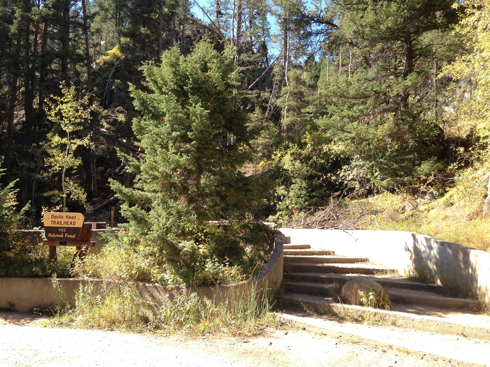
Photo break of the surrounding open space
Spruce Mountain Trail, just south of Larkspur was covered in snow, with depths anywhere from clear wind-swept earth to mid-thigh deep cold white.  Mostly the hiking was uneven and slippery. A couple hikers donned cleats over their boots like YakTrax or Katoola Micro Spikes which helped much with traction. Hiking poles helped a lot. Most of the rest of us just slipped along wearing anything on our feet from snow boots to tennis shoes.
We broke into bunches along the trail, talking about trips, asking questions of Ben, Polly and Jonathon and meeting other hikers in the group as we walked. Ben stopped for short breaks often and provided us with snacks and quiet time to enjoy the rocks and views of the surrounding Douglas County Open Space along the trail.
At one break, Jonathon read a post from Paul Salopek, a National Geographic journalist walking around the world on a 7 year journey, following the ascent of mankind in his Out of Eden Blog. The post was very well written and it made me think for a moment as if I were a discoverer. The link to the story is HERE if you are interested. I noticed nodding heads, listened to deep questions and saw thoughtful looks around the group. Ahh, my peeps, people who enjoy hiking AND intellectual writing : )

Beautiful weather with views north along the front range
The climb was fairly easy, the skies clear with the temperatures near the mid-50's.  It did get a little windy at Windy Point on the mountain top loop where Jonathon took photos of us, but was warm enough to begin melting snow on the return trip. I must say the weather was perfect for hiking!
All three Leaders were very interesting to talk with and like to share about the details of their respective trips. I, on the other hand, am shy in groups and do not typically engage with others I do not know. I usually just nod or say hi to another hiker I pass along the trail, so this is what has been missing for me. Communication with other people who enjoy the outdoors as I do; who also understand that solitude is a welcome caller, and who smile to the sound of the wind in the trees; who easily talk about places they have been, people they met, experiences they cherish.
Of course I had to leave the group before they went to lunch together and go in to work, and could not continue the communication we had all started. But I will return and hike more with Walk2Connect. They are running as many as 15 to 45 walks each week in Colorado, depending on the season. Check out their event calendar HERE to find a local walk for you.

Friday, December 18, 2015

Walking with 1000s of Miles tomorrow


I plan to walk with a group called 1000s of Miles and Life @3MPH tomorrow, Saturday December 19th from 9am to 3pm. We will meet at the Spruce Mountain Trailhead south of Larkspur and hike the trail together.  There is a $20 charge for this event.
This will be my first hike with this continental and global crossing group so I am excited.
There is some snow on the trail so plan accordingly.  Check out the Facebook post for a map and more information.
If you live in Colorado and have not yet planned to walk with this group, check out the groups Facebook site and join us for some fun!  You can sign up at the link above.  If you are a Life@3MPH member, there is a reduced charge.
See you on the trail.

Friday, December 11, 2015

A new cup and a half


I needed a new drinking cup for my daypack so I don't have to constantly move my one cup from my cooking gear in my backpack to my daypack and back every trip. 
While browsing at REI, I found the GSI Infinity Clear Polypropylene Stacking Cup. Available in both green and blue, the clear cup holds 14.2 fluid ounces, has one and a half cup measurements/mil liters molded on the side in a food grade polypropylene. BPA-Free and weighing 1.8 ounces this cup is lightweight, stackable, non-leaching and is 100% recyclable. The cup's handle is shaped like a hook, with an opening to mimic a steel/wire cup of old. Being polypro, it won't burn your lips when the tea is hot. The cup is also a bit flexible, so it will travel well jammed into a backpack. GSI makes a lot of really good gear for camping, and this cup, priced at $2.95, is another great low priced backpacking and camping item.
I like the light weight and comfortable feel. The handle keeps you from being burned with hot contents. Mine is green. If you have a camping partner, the two colors will help keep them "owned" during trips.
Disclaimer: I purchased this item at the Denver REI using my own money.

Friday, December 4, 2015

Candle Lanterns Now and Then

ECO Micro Candle Lantern outdoors
I have been using candle lanterns for many years as my outdoor light or lantern when backpacking. My first candle lantern was a simple one, without springs or fancy mechanisms. Just a glass jar with a bail to hang it in my tent or on a branch, with a metal bottom that screwed on and a small candle inside with an open top. I used this lantern for years during college when backpacking around Kentucky, Tennessee, Florida, Georgia and North Carolina. It warmed up the picnic table, the tent or the log I was sitting on. Not really bright enough to read by (though I did anyway), it did light the way for late cooking and when I didn't have a fire, it gave me something flickering to stare at until bedtime.
In the 1980's when I started upgrading my backpacking gear, I purchased a modern spring assisted candle lantern, one that was guaranteed to burn all the wax away. I used it to read Tolkien and science fiction paperbacks inside my tent. I kept the lantern inside a fleece pouch for safety and used it quite a lot. It was still in use in the early 2000's when I camped out with my son in the Boy Scout Troop. 

Collapsed to fit inside my pack
My most recent candle lantern is simpler and much lighter. It is a UCO Micro Candle Lantern which uses one tea light candle. Blue, it won't blend in with the leaves on the trees or on the ground (so it shouldn't get lost) and it is much smaller and lighter than the other ones I have owned. 
It gives me around 4 hours burn time per candle which is enough for a couple weekend trips (about 8 hours of light from both tea light candles), has a bail with a chain and hook for hanging, and has a glass chimney that stores inside the base. A feature I like is that it carries a spare tea light candle in the base.  It weighs only 4.2 ounces on my scale (3.9 ounces on the package) including the 2 tea light candles. I have not used it yet in the south so I have little experience with it reducing humidity in the tent. You could use citronella candles to keep the bugs away, clear plastic base candles for more light, or even beeswax tea lights for longer, gentle light. If dripping wax is too much for you, try a battery powered flickering plastic LED candle you can buy at Target. With candle tea lights it can warm up the tent just a little with an output of 450 BTU. 

All 3 peices
I have not tried to boil water over a candle like others online have. I say try it if you need to, but you are on your own.
The 15 lumens of light shines downward, (1 candle = 12.5 lumens or LUX) reflected from the top cap/vent, so hang it above your working/eating/reading area. Nowadays, I like to read about tomorrows trail and look at maps and maybe even write some notes about today's hike, who I met, etc.
It seems the best use for this candle lantern is in places where campfires are prohibited, as it gives you flickering "camper TV" to stare at until bedtime.
Much more earthy to use around the camp site than an LED headlamp (which I still carry), it is one of those few inexpensive camping gear purchases, costing under $14. At 4.2 ounces it is light and small enough to easily fit inside my ultralight backpack in the top pocket. The collapsed aluminum case covers the glass chimney, so it will be protected.
To use, twist the plastic bottom to the left.  This will allow you to separate the lantern to light the tea light candle. The tea light sits on a small aluminum stand above the plastic base. To get to the spare candle, hold the plastic base at the top and twist the bottom to the left to separate those bases. 

Weighs 4.2 ounces on my scale, 3.9 ounces is listed on the package
My trick is to pull apart the aluminum frame to extend the globe first before lighting the candle. The three supports will lock in place. To put the base back on the aluminum frame, twist it to the right. Remember to do this carefully without spilling any wax on your gear. Hang the bail on a branch or clip it inside your tent. 
To blow out the candle, blow in from the top while holding your hand behind the top to direct your breath inside the globe. Never leave the candle burning near children or pets and blow it out before leaving your tent. You can get burned by touching the glass chimney or the aluminum frame, so beware!

Hook and bail
The height opened is 3.5 inches, width is 2.25 inches, collapsed height is 2.5 inches. There are 2 accessories available; a top reflector and a Cocoon protective case. The top reflector may help prevent some temporary blindness when the candle lantern is placed on a table or log. I don't carry the cocoon since the glass is enclosed inside the aluminum frame. The UCO website has lots of other interesting items you should check out.
For durability, I give it only a barely passing grade. The aluminum frame can be bent, the glass chimney can be broken. You must be careful when using this. I am very gentle with all my gear. If it breaks and cannot be fixed, I will replace it at a later time. Yes, my older candle lantern was much better built and weighed 9-10 ounces, about what my whole cooking kit weighs now. It was bigger and made with thicker aluminum, plus the candle would last around 9 hours. For a similar burn time I have reduced the overall weight by over 5 ounces, and saved 2 inches of backpack pocket space.
Disclosure: I bought the UCO Micro Candle Lantern at REI using my own funds.

Friday, November 20, 2015

Snowshoeing to my car

Snowshoes, pole and 2 feet of snow
Snowshoeing through a parking lot may not sound like a lot of fun, but when the snow is too deep to walk in, walking on top of it is a much better idea.
It snowed fairly heavy in Castle Rock on Monday night, and the next morning left us with a Winter Wonderland of 2 foot deep snow, drifted in some areas over 4 feet deep. My snowshoes have not been used since we left Colorado over 10 years ago, so I was happy to put them on and stomp around a little.
This was the first major Colorado snow for this winter, burying the prairie all the way to Kansas and further east. Denver did not get as much snow as the storm mostly went south along the Palmer Divide, between Castle Rock and Colorado Springs.
I found I had not forgotten how to walk in snowshoes, even though I had lived in Florida for a decade since my last snowshoe trip. They went on pretty quickly, and came back off easily.
For the upcoming Thanksgiving Holiday I will not write a blog, as we have company and family time planned. I do hope to celebrate the holiday the way I feel all holidays should be enjoyed; outdoors. Maybe even in snow! And by the way, thanks REI for allowing your staff and shoppers a day to enjoy themselves outside.
I highly recommend you try snowshoes if you have not yet. If you missed it, read my snowshoe blog HERE. Even hiking short trails and walks in parks is peaceful and quiet, and you never know when you may need them.

Friday, November 13, 2015

New Shoe Test

Meadow and Red Rock
So I planned to hike a steep trail to test my new shoes. The trail I picked was Carpenter Peak Trail at Roxborough State Park, south of Denver. The trail is rated as strenuous and is quite steep, with sand and rock, along with some tall steps. It is also very peaceful, quite beautiful and not very busy. While my available time would not allow me to reach Carpenter Peak, I did hike half of the trail before turning around to make my time commitments.  A trail map is HERE.

Hiking through meadows

Hiking through scrub
Lots of scrub
The red rocks are always nearby
The trail starts out across from the Visitor's Center and starts very easy and level for the first half mile. Here it twists along the red rocks that Roxborough is famous for. Going in and out of tree cover along with the waist-high meadow grass makes for a varied view. The trail surface is mostly sandy here, a red, course sand from the red rocks.

View of the valley
Continuing to climb
Looking southeast
Climbing the railroad tie steps
Once you cross the dirt road, you begin to climb a steep section of trail with many railroad cross ties holding back the earth. Some of these steps are tall, requiring you to have firm footing before taking the next step. The trail then meanders up through an area with pine and scrub tree cover, zig-zagging quite a bit as it passes a bench on a point. The trail continues to climb and cut back across itself, the view of the valley below opening up as I gain elevation. Eventually, I make the last zag to the right and hike into a dark pine forest with very old trees. I pass the trail junction to Elk Valley and continue on towards Carpenter Peak. Then I continue through the scrub and more trees, still climbing until I reach an open area on a knoll, where there is a bench. Carpenter Peak is above me to the left. All of Denver is to my front right and it looks pretty small from up here.

Red rocks seen from above
And more red rocks from above
The Denver Tech Center is seen through red rocks
My turn around point, Denver is off to the right and very far away
I stop and drink some water, check the time and turn around to return to the car. The descent takes a little less time than the ascent did and I stop every now and then to enjoy the view. It must be bluebird day as I saw several along the trail. One even ran down a bit of the trail towards me, then abruptly turned to the right and promptly disappeared into the scrub. I paused to listen to a woodpecker unseen above me pounding into a tree. The wind whistled through the trees, making me smile.

From just below the knoll
Red rocks with Denver beyond
As for my new shoes, I had not even noticed them, which is good news! They stuck to the rocks and sand without slipping at all, even when my feet were at a steep angle where they should have slipped. I never had to re-tie or adjust them. Nothing was rubbed raw, and my toes didn't jam into the front of the shoe on the downhill either. They just did their job. And that is what I like, shoes that don't hurt anywhere, stick to the ground and still feel comfortable. With my won't-fit-anything feet, that is awesome!

Sign at entrance
Trail Map
Roxborough is a great park that focuses on hiking. They have wonderful programs for the children and families.  To get there, take US 85, Santa Fe, south of Denver, pass over C-470 and continue to Titan Road, where you turn right. Follow Titan Road as it climbs with open views in all directions. Titan Road bends south and changes its name to Rampart Range Road. Pass through the development and turn left at the Roxborough Park sign before entering the Arrowhead community and golf course. Follow this narrow road as it jogs to the right and turns to gravel. You come to the park entrance sign and a kiosk here. Pay the $7 fee to the Iron Ranger and continue to the last parking lot on the right. The Visitor Center is just ahead with Trailheads across from it.

Friday, November 6, 2015

New Hiking Shoes

Merrill Moab Ventilator in Walnut
My Montrail Mountain Masochist shoes have finally failed, after wearing them daily for over a year. They both lean to the outside and have lost support around the arch. I have not hiked in them since they failed, because they hurt my feet too much. They also failed very quickly over a couple weeks. 
I didn't buy another pair of Montrails because this is the second pair I have owned. My first pair wore out the same way in less than 3 months and I returned them to the company. Montrail kindly replaced them immediately and I have worn them almost daily for about 14 months. I'm sure the first pair was a manufacturing problem, but at over $100 per pair, I don't feel I can justify buying another set. Other, more serious hikers have also reported similar problems where the Montrail shoes wore out prematurely.
My new shoes are my old shoes: Merrill Moab Ventilators in a nice outdoor-friendly Walnut color.  I wore these shoes for 2 years in Florida and loved them until they wore out (I tend to do that to my shoes). I like the way the soles gripped the earth, logs, stones and moss without slipping. They were a little too short once my feet swelled up when hiking, so my new pair is one half a size larger. I tried them on a couple weeks ago to make sure they still fit and they do. I tried on Solomon's too, but prefer the Merrill's.
They will work great as casual walkers and as my main hiking shoes once the weather warms up and the snow is gone in spring. They too will wear out as all other shoes do, just maybe not until I have hiked in them over a year or so. I didn't get the waterproof shoes as those are too hot for me. 
I have also been busy lately moving into a new place, getting accustomed to my new job and spending time enjoying the Colorado outdoors with my wife. I plan on getting outside this winter as much as I can, whether bicycling, hiking, backpacking, snowshoeing or taking road trips. My new Merrill shoes will help with all this.

Friday, October 30, 2015

Winter Hiking Prep


Trail Ridge Road Closed Under Snow - 5 Days Ago
Snow has already fallen across the peaks of Colorado. Trail Ridge Road in Rocky Mountain National Park is closed under 3 foot deep drifts. Cold white blankets the front range mountains above treeline. Aspen leaves have already fallen. Winter is not far away.
I'm looking forward to swishing through the snow with my snowshoes, with the peace and the natural quiet, and with the wind in the trees. When you are snowshoeing in the mountains, it can be a peaceful existence. Or it can be a loud, boisterous one with friends laughing, joking about the cold and talking about the hot chocolate in your pack. It can be a source of wonder to your children, a source of angst for the returning cross-country skiers whose tracks you just obliterated, a source of pride for reaching the pass under your own power. Snowshoeing is just plain fun, and easy.
My first few trips snowshoeing in the Colorado Mountains were short as I adjusted to dealing with these new and wide "boards" strapped to my feet. I quickly learned not to pass too close to fir and pine trees as the snow-free zone buried under their boughs could suck you under quickly. Crusted show would break through easily and you could be struggling waist-deep in powder. Falling down could mean having to remove the snowshoes just to stand back up, and don't drop your poles!
Similar to my older snowshoes
There were some awesome trips too. Poking around the woods by the stream just past Winter Park with my family was awesome! Children are so much lighter than adults and can sometimes walk on top of the snow while we sink in to our thighs. Snowshoeing with my children on the back side of the mountains behind Georgetown was a great experience. Watching avalanches rolling off 13,000 peaks around me was beyond my words to describle. Getting caught by a black cloud rolling down the slopes hiding a surprise winter storm with the temperature dropping 30 degrees in the hour while I trudged back to my truck, already buried in snow (I dig navigate my truck to the highway in time and got home OK). 
Mount Evans and Mueller State Park in the winter were incredibly bright day trips. Then there was that winter trip to Breckenridge with family and friends, where the trail just kept going up and up, and once past the ski runs, I was immersed in perfect solitude until I walked out of my broken snowshoe. The 2 grommets holding the cleat to the straps had worn/broken free. I picked up the pieces and walked back to the lodge, using the good snowshoe to break the snow down to step into with my boot-only foot.
I fixed that snowshoe by replacing the grommets with bolts and washers.  I keep some spares with me in case it happens again and always carry 2 small wrenches to tighten them up.
As a family, we owned a few snowshoes. My children each had models made for their light weight and my wife had a set of 20" snowshoes. We all had 2 piece snowshoe poles. I owned a pair of 30" snowshoes for backpacking and my favorite 27" snowshoes, which I still have.  
Snowshoe poles
I also have one snowshoe bag/backpack and 2 sets of poles left, one pole set I put small baskets on and use for hiking and backpacking. In my pack I have a section of old aluminum tent poles, held together with a bungee cord inside that can double as a rescue probe. Typically I check contour maps prior to a trip to avoid hiking too close to avalanche zones, so I hope to never need to search for anyone. Until trained in avalanche awareness and carrying avalanche beacons, I suggest staying far away from 20 degree avalanche chutes! I also carry a collapsible snow shovel to dig a snow cave or rescue my vehicle. I always carry extra socks and warmer gloves. a winter overcoat, a stove with tea, food and emergency supplies to survive the cold night out if needed.
Snowshoeing makes you heat up fast, so I usually wear a light weight wicking base layer, water-proof/breathable rain pants, gaiters, snow boots, 2 pairs wicking socks, a polar plus 300 jacket (with pit zips) a knit hat and liner gloves. Don't forget your sunglasses to avoid snow blindness. I would keep moving to keep warm, and would put on my water-proof/breathable jacket and winter gloves when the wind picked up. Hiking through the snow can wear you down quickly, so eat every 2 hours or so on the trail and drink plenty of water. Hot chocolate in a thermos is a great pick-me-up after a cold hike too. 
Snowshoeing is fairly easy to do.Strap them on over your snow boots snugly and use your poles for balance. Just walk with wide steps so you don't step on your own shoes. Avoid getting too close to the base of pine and fir trees to keep from falling into the void, like I mentioned above. If it gets too steep to cross a hill either sideways or vertically, kick your steps in with the snowshoes. Allow the cleats to dig in for traction, especially into ice when crossing streams. Sometimes, climbing steep patches with lots of rocks near the surface can be tricky; use your poles, take small steps, and keep moving forward. Keep your weight centered above the center cleat of the snowshoes. If there are parallel tracks from cross country skis in the snow, stay off them as someone else may need them! Classes are available at stores like REI, many ski resorts and Nordic centers. Snowshoes are rent-able too, if you want to try them out first.
I have thoroughly enjoyed snowshoeing and look forward to getting out a few times this winter. I'll try to get to hike in interesting places and will share those with you as they happen. Don't let winter keep you inside, get out there and hike!

Friday, October 23, 2015

Devils Head 2015


Devils Head Fire Tower
I finally hiked up to one of my favorite Colorado locations, Devils Head this fall. What I remembered from 20 years ago as a 20 minute hike actually takes about an hour to go one-way. So much for my memory...
It was one of the clearest, brightest blue skies I had seen in some time. The area wildfire smoke had been blown away by the cool breezes and the fall color was in bloom. Devils Head Fire Tower turns 103 years old this year.
I wrote last about this trail HERE, of when I used to live with my family in Colorado. I have moved back to Colorado last year and will be staying for awhile.
The drive from Sedalia up to Rampart Range Road was quiet and cool, driving through the front range ridges twisting and turning into the Pike National Forest. Turning left onto gravel Rampart Range Road was nice too as the road passes campsites and motorized vehicle trails, small 4 wheelers and off-road motorcycles. It is an 8-mile drive over the washboards at 20 MPH to the Devils Head Trailhead. Camping and a picnic area are available there also.

Trailhead
Trail Damage by an EF1 Tornado


The hike starts in a blow down of trees that happened this July 21st, caused by an EF1 Tornado. Trees are scattered in every direction, many blown down or snapped off. A once-beautiful Aspen grove laid toppled, the large trees mostly blown over. Cut logs laid stacked everywhere where they had to cut most everything to clear the trail.
Years ago I had backpacked through such a tornado tangle in eastern Kentucky. Crawling over and under still loose and sliding trees, it was one of the hardest things I had ever done. I ended up removing and pushing my backpack ahead of me or pulling it behind me through the snarl. Smaller than this area, it still took me 2 hours to cross about one hundred fifty yards and made me late to reach camp that night.

Remaining Aspen Grove
More Aspen
Marsh-mellow Rocks
Past the damage, the trail once again is filled with trees and the Pikes National Forest area 'marsh-mellow-shaped granite rocks'. The trail climbs about 15 switchbacks and is sandy and gravelly underfoot. A sign at the halfway point lets you know how much farther you have to go. Picnic tables and benches are spaced along the way, and views in all directions are really cool.

Halfway Point
View West to one of the Devils 'horns'
View East
I finally reach the top area which holds the Ranger's cabin with its new roof and the fire tower lookout. Like a mountain cove, this area is surrounded by great rocks. This is the last "manned" fire tower in all of America. The ranger gives out cards to those who climb the 143 steps to the top. I climbed up to 9478 feet and enjoyed the wide open views, snapping some photos before heading back.  I turned down another completion card from the fire tower Ranger, telling him I still had the card he gave me 2 decades ago.

Ranger's Cabin
Stairs up to the tower
View Southeast
View Northeast
View North
View South to Pikes Peak
View West across Pike National Forest
The trail back down went by much faster than the one coming up, even though it was the same trail. The over-full parking lot still had cars coming in, with more coming in along the return drive on Rampart Range Road. I enjoyed my hike to Devils Head and the Fire Tower, the fall color and the cool temperatures.

Steel strips cemented to prevent sliding
Enjoying one last trip through the aspens
To get to Devils Head go south from Denver on I-25 to exit 184 at Castle Rock, Founders Parkway. Go right (west) to Highway 85, then right at the second light to go north on 85. Follow about 8 miles to Sedalia, turn left at the light onto CO 67. Follow the winding road to Rampart Range Road, turn right (south). Follow Rampart Range Road south 8 miles to the Devils Head entrance and park. The gravel road has a 20 MPH speed limit. Bring plenty of water. The trail is about 1.4 miles long and gains 940 feet in elevation.