|
| Campsite at the midpoint of Rich Creek and Tumble Loop. |
This backpack trip has been on my list for a long, long time.
Buffalo Peaks Wilderness is not your typical Colorado mountain backpack trip. The area is still high in elevation, but has no high peaks or sheer cliffs to navigate along the trail. It is mostly an area of meadows and forest, with 2 streams to navigate by, and mostly an easy climbing or descending trail.
The trail is called
Rich Creek and Tumble Loop, a 12 mile backpack trip, starting at about 10,000 feet elevation with an elevation gain of 2036 feet. Listed as easy to moderate, we found the stream crossings to have relatively high, fast water to cross, which added a layer of difficulty. The rainfall and snow melt this year has been very high. The trailhead is about 17 miles southwest of Fairplay in South Park and is best followed counter-clockwise.
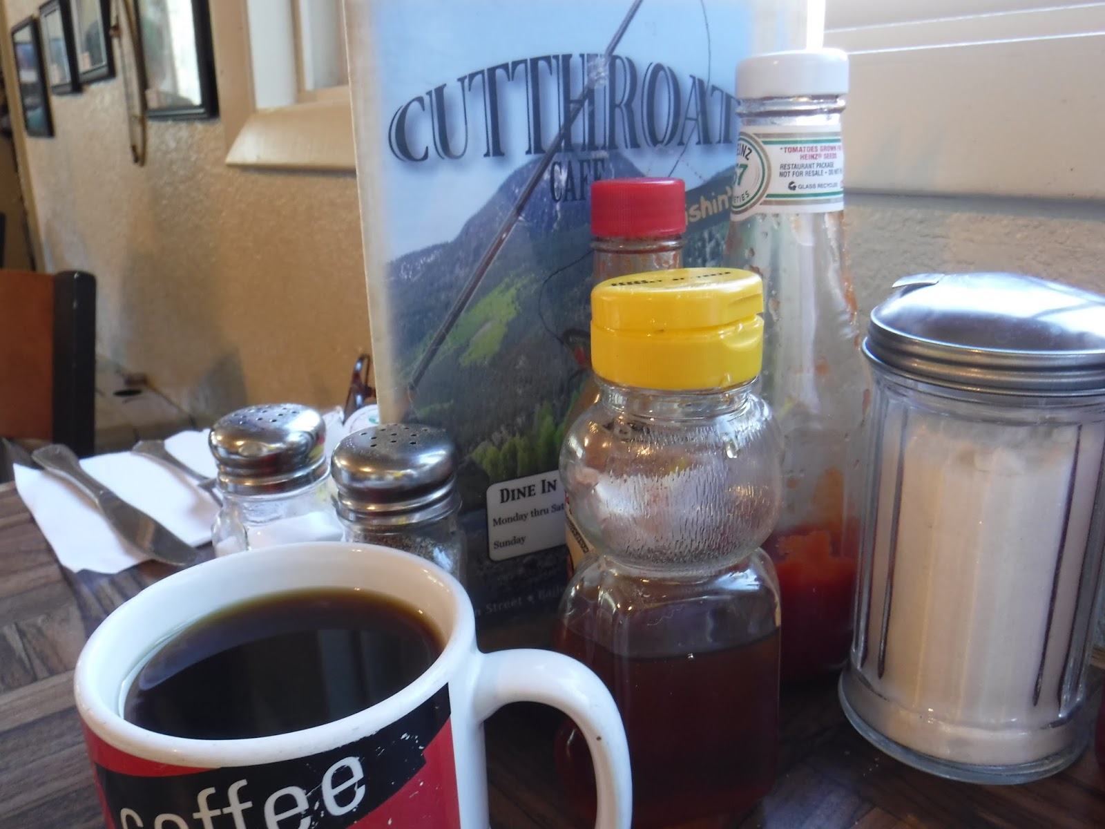
En route to Fairplay, we stopped in Bailey to eat breakfast at the Cutthroat Cafe. The food was really good, the service was great and we both left, full and satisfied.
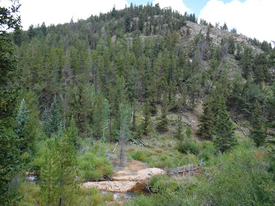
Arriving at the trailhead, we hoisted our backpacks and crossed the bridge over Rich Creek. From there, the trail goes right and follows Rich Creek through the forest. We came to a dual log stream crossing over the creek to the north side, crossed and turned left to continue through the forest. The campsites here were very nice and we remarked how nice it would be to camp here for multiple days and explore the area.
 |
| Blazes and trail |
 |
| Hill to the north |
 |
| Just below the crossing on Rich Creek |
 |
| The first valley clearing |
 |
| Thataway> |
 |
| Trail side beaver pond |
 |
| Aspen Leaf |
 |
| More trees, more trail |
 |
| More open trail |
 |
| Trail continues |
 |
| Continuing the climb, that's the mountain we are backpacking around |
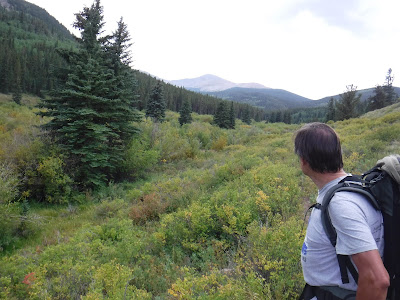
Climbing over a rise, we came out to the meadow, with wide open views of the round-top mountains. Remains of a cabin peeked from the willows on the right. Birds were everywhere, the sky a dark blue, a light breeze from the west where rain clouds would form and un-form through the day. Stopping for a few minutes we spoke to a couple walking their dogs for the day. We followed the meadow trail for a few hours, finally turning south where we crossed Rich Creek for the last time today, filtering water in the gold tinted stream.
 |
| More meadow, more stream |
 |
| Turning southwest, note the clouds |
 |
| Stone pile and wildflowers by the trail |
 |
| Leaving the meadow, David up ahead |
 |
| Looking west |
 |
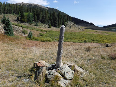
| Trail side stump in the trees, birds were everywhere |
Here we left the meadow, climbing a hill in the forest. Views of the mountains to our west poked through the trees. Birds continued to flit about. As we began climbing down again, the sky started to sprinkle, but not enough to get us wet. Arriving at our campsite, we setup our tents just as the sky opened up and poured. Tired, I set the alarm and slept solid for about an hour.
Woken by my alarm, I took the stove and food in the rain over to David's tent, where I cooked dinner for the night. After dinner we listened to coyotes howl, then scream, their voices echoing in the mountains. It was hauntingly beautiful.
At one point later in the evening we noticed a Collegiate Range mountain peeking through to the southwest, and believe it was Mount Yale or Turner Peak.
 |
| Across from our campsite to the south |
 |
| View from my tent in the morning |
 |
| "Leave no trace" dry spots where our tents were pitched |
 |
| David does sunscreen |
 |
| That's our first view of the Buffalo Peaks to the south |
 |
| View south into the park |
 |
| Morning trail side sun |
In the morning, when David asked if I was awake, I told him I needed some more sleep and went right out for another 20 minutes. Waking up, I dug out breakfast and took it to David's tent where we sat eating. The rain had stopped sometime in the morning, but our tents were soaked on the outside. We snapped our tarps with rain flying off in all directions, then hung them in low trees in the sunlight around us. I dried my tent off with my pac-towel and packed everything up.
Walking east now, we were following Tumble Creek as it flowed downhill through the meadow valley, mostly walking in full sun.
 |
| Aspen just beginning to change color |
 |
| Colorful stumps near the campsite |
 |
| The beginning of Tumble Creek Trail |
 |
| That's South Park in the distance |
 |
| From shadow to full sun all morning |
 |
| David filtering his water in Tumble Creek |
 |
| The forest opens up |
After a few miles of bright, sunny weather along the creek in the open valley, we zig-zagged down the lightly forested slope to Tumble Creek where we crossed using the high-low bridge, hands on top, scooting our feet across the bottom logs. We then followed the creek again, gaining altitude above it for some time. Turning right into the thinning woods, we took a break before continuing downhill. The mountain ahead of us called Jones Hill told me we would be turning east soon. Here we paused near a trail crossing, then crossed the stream on a wide log, heading east and uphill. That was the best bridge across a creek all weekend. There were a couple campsites by the trail. The valley to our right held multiple lakes and beaver dams, flowing on downhill. We walked beside the stream and gained elevation. Here the forest was mostly aspen and was very thin.
 |
| Buffalo Peaks Wilderness Area |
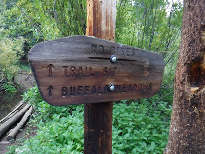 |
| No Bikes |
 |
| More trails |
 |
| The best bridge all weekend |
 |
| David looking back at the north side of Buffalo Peak |
 |
| Another beaver lodge |
Continuing to climb, we eventually reached the top of the rise with views of South Park to the east, and started down into a thicker forest, turning northeasterly. A couple passed us near the top wearing day packs.
Working our way downhill through the forest, we eventually heard the sound of flowing water below us. That was the sound of Rich Creek, where we parked yesterday morning. Coming out at the bottom of the trail, we crossed Rich Creek on the bridge again and reached the car. The drive home was pleasant, while somewhat jarring to our calmed outdoor senses.
 |
| Up the last mountain for the day |
 |
| Very thin tree cover with the Buffalo Peaks behind it |
 |
| Near the top |
To get there from Denver, head west on US 285 to Fairplay. From Fairplay, continue 5 miles south on US 285, turning right onto Park County road 5 (Weston Pass Rd). Drive about 7 miles and turn right at a major intersection onto County road 22 (AKA Forest Rd 425) and continue 2.9 miles to the Rich Creek Trailhead cement pad parking area on the left.
 |
| Various flowers and buds along the trail... |
 |
| More various flowers |
 |
| These guys were everywhere |
 |
| Wild rose, I think |
 |
| Little trees |
 |
| Pine Nuts |
 |
| Blue Flower |