Friday, October 30, 2015

Winter Hiking Prep


Trail Ridge Road Closed Under Snow - 5 Days Ago
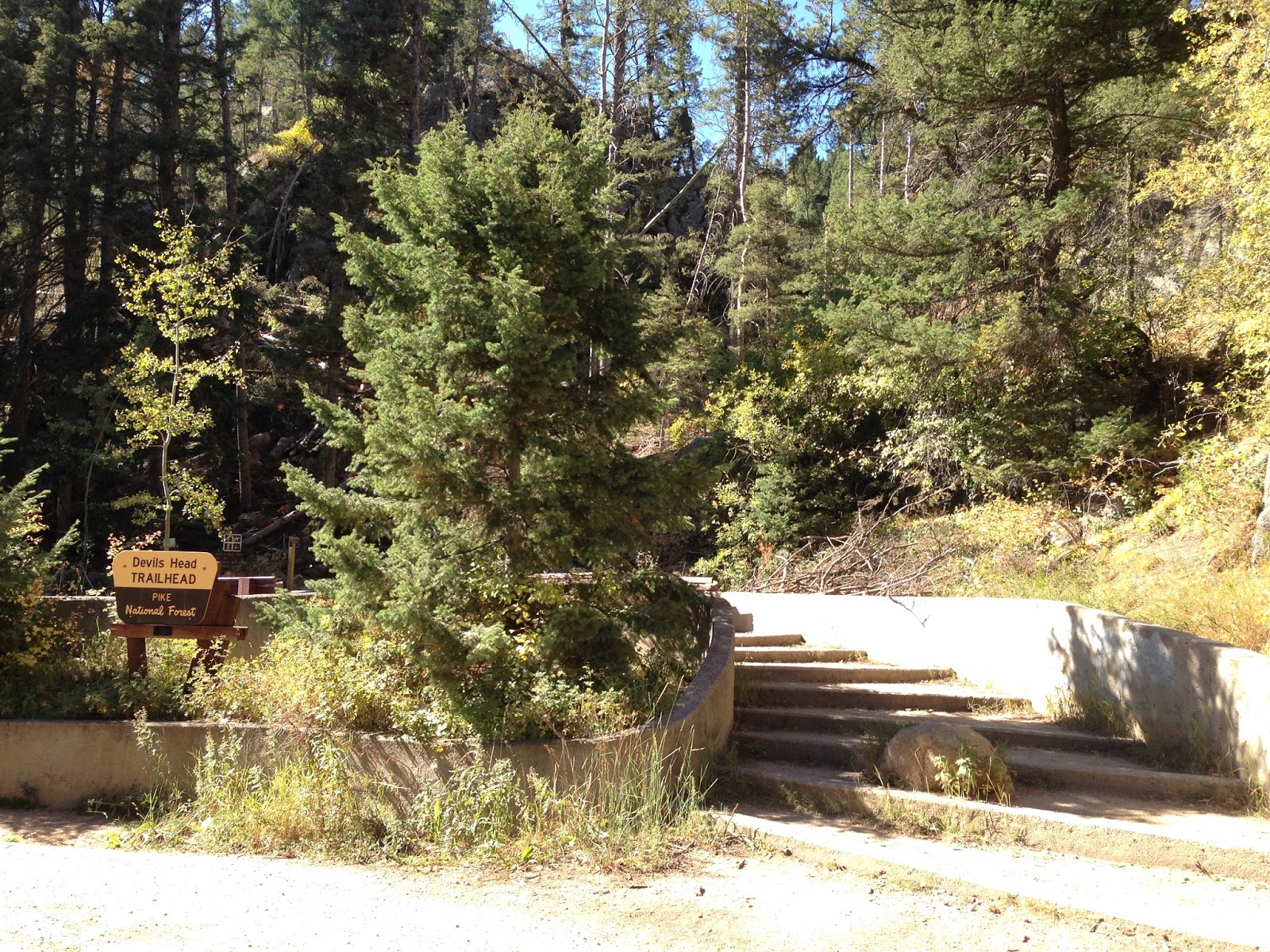
Snow has already fallen across the peaks of Colorado. Trail Ridge Road in Rocky Mountain National Park is closed under 3 foot deep drifts. Cold white blankets the front range mountains above treeline. Aspen leaves have already fallen. Winter is not far away.
I'm looking forward to swishing through the snow with my snowshoes, with the peace and the natural quiet, and with the wind in the trees. When you are snowshoeing in the mountains, it can be a peaceful existence. Or it can be a loud, boisterous one with friends laughing, joking about the cold and talking about the hot chocolate in your pack. It can be a source of wonder to your children, a source of angst for the returning cross-country skiers whose tracks you just obliterated, a source of pride for reaching the pass under your own power. Snowshoeing is just plain fun, and easy.
My first few trips snowshoeing in the Colorado Mountains were short as I adjusted to dealing with these new and wide "boards" strapped to my feet. I quickly learned not to pass too close to fir and pine trees as the snow-free zone buried under their boughs could suck you under quickly. Crusted show would break through easily and you could be struggling waist-deep in powder. Falling down could mean having to remove the snowshoes just to stand back up, and don't drop your poles!
Similar to my older snowshoes
There were some awesome trips too. Poking around the woods by the stream just past Winter Park with my family was awesome! Children are so much lighter than adults and can sometimes walk on top of the snow while we sink in to our thighs. Snowshoeing with my children on the back side of the mountains behind Georgetown was a great experience. Watching avalanches rolling off 13,000 peaks around me was beyond my words to describle. Getting caught by a black cloud rolling down the slopes hiding a surprise winter storm with the temperature dropping 30 degrees in the hour while I trudged back to my truck, already buried in snow (I dig navigate my truck to the highway in time and got home OK). 
Mount Evans and Mueller State Park in the winter were incredibly bright day trips. Then there was that winter trip to Breckenridge with family and friends, where the trail just kept going up and up, and once past the ski runs, I was immersed in perfect solitude until I walked out of my broken snowshoe. The 2 grommets holding the cleat to the straps had worn/broken free. I picked up the pieces and walked back to the lodge, using the good snowshoe to break the snow down to step into with my boot-only foot.
I fixed that snowshoe by replacing the grommets with bolts and washers.  I keep some spares with me in case it happens again and always carry 2 small wrenches to tighten them up.
As a family, we owned a few snowshoes. My children each had models made for their light weight and my wife had a set of 20" snowshoes. We all had 2 piece snowshoe poles. I owned a pair of 30" snowshoes for backpacking and my favorite 27" snowshoes, which I still have.  
Snowshoe poles
I also have one snowshoe bag/backpack and 2 sets of poles left, one pole set I put small baskets on and use for hiking and backpacking. In my pack I have a section of old aluminum tent poles, held together with a bungee cord inside that can double as a rescue probe. Typically I check contour maps prior to a trip to avoid hiking too close to avalanche zones, so I hope to never need to search for anyone. Until trained in avalanche awareness and carrying avalanche beacons, I suggest staying far away from 20 degree avalanche chutes! I also carry a collapsible snow shovel to dig a snow cave or rescue my vehicle. I always carry extra socks and warmer gloves. a winter overcoat, a stove with tea, food and emergency supplies to survive the cold night out if needed.
Snowshoeing makes you heat up fast, so I usually wear a light weight wicking base layer, water-proof/breathable rain pants, gaiters, snow boots, 2 pairs wicking socks, a polar plus 300 jacket (with pit zips) a knit hat and liner gloves. Don't forget your sunglasses to avoid snow blindness. I would keep moving to keep warm, and would put on my water-proof/breathable jacket and winter gloves when the wind picked up. Hiking through the snow can wear you down quickly, so eat every 2 hours or so on the trail and drink plenty of water. Hot chocolate in a thermos is a great pick-me-up after a cold hike too. 
Snowshoeing is fairly easy to do.Strap them on over your snow boots snugly and use your poles for balance. Just walk with wide steps so you don't step on your own shoes. Avoid getting too close to the base of pine and fir trees to keep from falling into the void, like I mentioned above. If it gets too steep to cross a hill either sideways or vertically, kick your steps in with the snowshoes. Allow the cleats to dig in for traction, especially into ice when crossing streams. Sometimes, climbing steep patches with lots of rocks near the surface can be tricky; use your poles, take small steps, and keep moving forward. Keep your weight centered above the center cleat of the snowshoes. If there are parallel tracks from cross country skis in the snow, stay off them as someone else may need them! Classes are available at stores like REI, many ski resorts and Nordic centers. Snowshoes are rent-able too, if you want to try them out first.
I have thoroughly enjoyed snowshoeing and look forward to getting out a few times this winter. I'll try to get to hike in interesting places and will share those with you as they happen. Don't let winter keep you inside, get out there and hike!

Friday, October 23, 2015

Devils Head 2015


Devils Head Fire Tower
I finally hiked up to one of my favorite Colorado locations, Devils Head this fall. What I remembered from 20 years ago as a 20 minute hike actually takes about an hour to go one-way. So much for my memory...
It was one of the clearest, brightest blue skies I had seen in some time. The area wildfire smoke had been blown away by the cool breezes and the fall color was in bloom. Devils Head Fire Tower turns 103 years old this year.
I wrote last about this trail HERE, of when I used to live with my family in Colorado. I have moved back to Colorado last year and will be staying for awhile.
The drive from Sedalia up to Rampart Range Road was quiet and cool, driving through the front range ridges twisting and turning into the Pike National Forest. Turning left onto gravel Rampart Range Road was nice too as the road passes campsites and motorized vehicle trails, small 4 wheelers and off-road motorcycles. It is an 8-mile drive over the washboards at 20 MPH to the Devils Head Trailhead. Camping and a picnic area are available there also.

Trailhead
Trail Damage by an EF1 Tornado


The hike starts in a blow down of trees that happened this July 21st, caused by an EF1 Tornado. Trees are scattered in every direction, many blown down or snapped off. A once-beautiful Aspen grove laid toppled, the large trees mostly blown over. Cut logs laid stacked everywhere where they had to cut most everything to clear the trail.
Years ago I had backpacked through such a tornado tangle in eastern Kentucky. Crawling over and under still loose and sliding trees, it was one of the hardest things I had ever done. I ended up removing and pushing my backpack ahead of me or pulling it behind me through the snarl. Smaller than this area, it still took me 2 hours to cross about one hundred fifty yards and made me late to reach camp that night.

Remaining Aspen Grove
More Aspen
Marsh-mellow Rocks
Past the damage, the trail once again is filled with trees and the Pikes National Forest area 'marsh-mellow-shaped granite rocks'. The trail climbs about 15 switchbacks and is sandy and gravelly underfoot. A sign at the halfway point lets you know how much farther you have to go. Picnic tables and benches are spaced along the way, and views in all directions are really cool.

Halfway Point
View West to one of the Devils 'horns'
View East
I finally reach the top area which holds the Ranger's cabin with its new roof and the fire tower lookout. Like a mountain cove, this area is surrounded by great rocks. This is the last "manned" fire tower in all of America. The ranger gives out cards to those who climb the 143 steps to the top. I climbed up to 9478 feet and enjoyed the wide open views, snapping some photos before heading back.  I turned down another completion card from the fire tower Ranger, telling him I still had the card he gave me 2 decades ago.

Ranger's Cabin
Stairs up to the tower
View Southeast
View Northeast
View North
View South to Pikes Peak
View West across Pike National Forest
The trail back down went by much faster than the one coming up, even though it was the same trail. The over-full parking lot still had cars coming in, with more coming in along the return drive on Rampart Range Road. I enjoyed my hike to Devils Head and the Fire Tower, the fall color and the cool temperatures.

Steel strips cemented to prevent sliding
Enjoying one last trip through the aspens
To get to Devils Head go south from Denver on I-25 to exit 184 at Castle Rock, Founders Parkway. Go right (west) to Highway 85, then right at the second light to go north on 85. Follow about 8 miles to Sedalia, turn left at the light onto CO 67. Follow the winding road to Rampart Range Road, turn right (south). Follow Rampart Range Road south 8 miles to the Devils Head entrance and park. The gravel road has a 20 MPH speed limit. Bring plenty of water. The trail is about 1.4 miles long and gains 940 feet in elevation.

Friday, October 16, 2015

Review - A Walk In The Woods

My Walk In The Woods movie ticket
It was spring 1970, and a lonely teenager told his parents one afternoon that he was going to hike the Appalachian Trail that summer. He was an active Boy Scout and was well trained in the outdoors and he could take care of himself. And that he was going with this girl. Apparently that was all the wrong things to say. The ensuing eruption of parental angst was legendary and still today reverberates in the neighborhood trees of rural Kentucky. The unhappy result was that trip did not occur...yet. Maybe soon, though, and without that girl.
A Walk In The Woods by Bill Bryson is still a fond book with awesome humor and a different life perspective from the other side of the pond that I appreciate. The film, directed by veteran Television and film director Ken Kwapis, stars actors Robert Redford and Nick Nolte and the Appalachian Trail. Kwapis also directed Route 66, The Sisterhood of Travelling Pants and many other feature films and television shows. This film explores relationships, and how they still show connected-ness even after years of being apart; what had originally brought them together then, now holds them together on an adventure today. Like the book, the film highlights more than a few humorous moments, like when Bryson's wife scoffs in her British accent "You want to hike the Appalachian Trail, 2000 miles... you could die out there." My wife would say that too, without the accent. And she would demand that someone goes with me for safety along the trail, which in the story is just how Katz tags along.

Movie poster shot at McAfee Knob
The film crew spent a lot of energy and resources on location shooting of the Appalachian Trail as the third character of the film. Aerial shots of the hikers crossing the Fontana Dam and the starting point of the trail at the Amnicolola Lodge, entering the Smokey Mountains National Park, views of the Bryson and Katz on the precipice of McAfee Knob, (the most photographed site along the AT overlooking the Catawba Valley and North Mountain in Virginia), Springer Mountain, Neels Gap, other hikers like the 'annoying' Mary Ellen and the 2 younger backpackers who offer unwanted help, and the open-sided AT shelters providing the only real shelter during thunderstorms. A favorite scene is Bryson wearing long underwear in the dark while facing two bears in the campsite, standing up in his tent reading out loud to Katz "Stand up as tall as you can to intimidate the bear".


The film has a deeper message about the future of the AT, one we all need to hear about responsibility, respect for the trail and for all of our National Parks. It is up to all of us to preserve and protect the Appalachian Trail and all other outdoor areas in America. Check out the Public Service Announcement from Robert Redford.
The film crew worked with the Appalachian Trail Conservancy to show the trail as backpackers see it; a community of different people hiking together and separately reaching common goals, with actually some of the best of what American Community Spirit has to offer. The crew felt an obligation to work with the Conservancy and the hikers to do it the right way. I really enjoyed the film, as a hiker, an ultralight backpacker, an Eagle Scout, a lover of the "Green Tunnel", a media professional and a writer.
Robert Redford plays an older, more conservative Bill Bryson than presented in the book and Nick Nolte plays a more outlandish rogue of Steven Katz. The balance works well for me and the humor is still very good. In Bryson's book that I still re-read, the two hikers never do complete the trail, but are still happy with what they accomplished. They HIKED the Appalachian Trail!
Which is what my parents should have allowed to happen back in 1970. Maybe I would have finished the trail and come back, completed high school, gone on to college and perhaps attacked life in a different way than I did. And that is what the Appalachian Trail is all about.

Friday, October 9, 2015

Road Trip - Taos, NM

Loretta Chapel Mysterious Spiral Staircase
We were going to Taos, but before leaving Santa Fe we visited the Loretta Chapel, home of the miracle staircase.  The story told is that the sisters of the chapel needed to have a stairway built to reach the choir loft 20 feet above the floor of the church as a ladder just didn't work in the space they had. Praying for help brought them a man who mysteriously built a spiral staircase without supports. That staircase was a miracle for the sisters and the church and it still stands today. I have read scientific studies about the staircase where they tested the wood and found it to be "petrified", which may give the wood enough strength to stand by itself. How this man treated the wood is still a mystery and how he designed and built the stairs using only simple tools is also a mystery. He also left without payment which only adds to the story.

San Francisco De Assisi
On the way to Taos, NM from Santa Fe, we drove through the Rio Grande canyon and along the valley on NM 68. At Ranchos De Taos, we stopped to get a photo of the San Francisco De Assisi church, one of the most photographed adobe sites in America.
In Taos, we visited the Kit Carson Home tour. At $7 per person, it only covered 3 sparsely furnished rooms and a History Channel film. I know the house was always small, but for all Kit Carson had done for the western United States, I had hoped for a better, much more informative tour. Read Hampton Sides book Blood and Thunder to get the real story on Kit Carson, you will be glad you did.
The rain finally caught up with us as we left Taos and climbed to Angel Fire, before descending Cimarron Canyon.  We drove through the canyon and the Cimarron Canyon State Park.  Stopping at the Palisades Sill on US 64, we took a photo of the beautiful rock walls echoing the sound of the stream. These cliffs were made by the Cimarron river cutting through igneous rock known as a sill. The rock was emplaced some 40 million years ago as the Rocky mountains uplifted. The elevation here is 8000 feet above sea level. This is another place I will return.

Looming above us the Palisades Sill
At Cimarron, we turned south along the Santa Fe trail and came to the Philmont Boy Scout Ranch. I backpacked there in the summer of 1971 and it changed my life. It was late and was raining at the time, so we didn't get out to visit anything. It was nice to show my wife where I enjoyed a great 2 weeks so long ago. And I'll be back!

Tent City at Philmont Scout Ranch
Our route was north from Santa Fe to Taos along US 285 and NM 68, then US 64 to Cimarron, and on to Raton, NM where we joined I-25.


Friday, October 2, 2015

Road Trip - Trinidad, CO

Fishers Peak looming above Trinidad
The Pueblo Riverwalk is a very nice development, much like what a large city would accomplish.
It covers 32 acres in downtown Pueblo and follows the original river path. The river was relocated in the 1920's due to disastrous flooding. In its history, 4 nations have claimed the Arkansas River at this location; Mexico, Spain, France and the Republic of Texas.
Boats are available and include paddle boats for paddle-it-your-selfers, gondolas for romantic tours and an excursion boat to travel with your group. The Farmers Market meets there weekly and the calendar is full of events throughout the year. The morning we visited, the trail was full with people getting their morning walk in before work.
Pueblo Riverwalk
Trinidad Colorado was once a major center for trade along the Santa Fe trail, and the trail ran right through downtown. The community was founded in 1862 after coal was discovered in the area. The Achison, Topeka and Santa Fe railroad reached the town in 1878 and Bat Masterson briefly served as the town's Marshall in 1882.

Santa Fe Trail Map
The Santa Fe Trail was an important route of commerce between the US and Mexico between 1821 and 1880. The Trails' mountain pass taken to bypass the dangerous Plains Indians, passed through Trinidad which began as a Santa Fe Trail campsite along the Purgatoire River. The museum also documents labor actions and the Ludlow Massacre which occurred just up I-25 from Trinidad.
We toured the Baca House, the Bloom Museum and the Santa Fe Trail Museum, all managed by History Colorado.

Baca Houe
A Santa Fe Trail entrepeneur, John Hough completed building his house in 1870. 3 years later, he sold the house to Felipe Baca for 22,000 pounds of wool. The Bacas were sheep hearders and the trade was a good one, as Mr. Hough was able to transport the wool back east and (we assume) sell it at a profit. The Territorial-style residence combines Greek Revival architecture with adobe construction. Inside the house is quiet and well insulated. The widows walk was added by the Houghs.  The roof is tin, which was readily available locally. The garden out back supplied the summer kitchen and fed the family.

Santa Fe Trail Museum
The Santa Fe museum was originally a barn with 2 additions. The rooms actually stored Santa Fe Trail history for many years before becoming a museum. Many Trinidad buildings were built in the same way with adobe, but very few survive today.

Bloom Museum
The Bloom Museum was built in 1882 in a French Second Empire style, common after the Civil War. And yes, it looks like the Munsters live here. It is built with locally made bricks, the house has a central tower, an added wrap-around porch with finished wood carvings and iron cresting. The blue spruce tree on the east side was planted in 1910. A recent earthquake damaged the building. The furniture has been removed and repairs are underway. Tours are still being held.
The 2 house tour was well led with lots of information about the families, the houses and the community. I highly recommend it.
Pueblo is 2 hours south of Denver on I-25. To reach the Riverwalk, exit at 98B, turn right then go left at S. Main Street and park.
To find Trinidad, head south from Denver on I-25 for 3 hours, 15 minutes.  Exit at 13A right into downtown, turn left on highway 160. Follow east to the museum and houses..