Friday, July 24, 2015

Road Trip - Rocky Mountain National Park

Lone cloud above Longs Peak at Rocky Mountain National Park
It was past time for a road trip to Rocky Mountain National Park (RMNP).  Neither my wife nor I could remember the last time we were there over a dozen years ago.  RMNP was one of our favorite places to take our children when we lived here.
On our first Colorado visit in 1989, RMNP was were we tent camped two nights, receiving snow the second night.  That inch of snow at our campsite made it impossible to climb Long's Peak, and drove us to drive across the mountains of the state to spend the rest of our vacation time at Mesa Verde National Park.  That was a fantastic vacation, and led me to apply for jobs in the west which eventually resulted in us moving to Colorado 3 years later.
It was a 2 hour drive for us today and we arrived in the park well before lunch.  At the Rocky Mountain National Park entrance, we bought an annual pass for only twice the price of the daily admission (we only need to visit twice in a year to get our money's worth).  Our plan is to return to RMNP many times during the year, camp, hike and enjoy the area.

Across from Forest Canyon Overlook
As we had done several times in the past, we just drove up Trail Ridge Road, stopping at the Forest Canyon Overlook first.  Here the overlook clearly shows glaciation with signs showing what the area used to look like under all the ice. That was 10,000 years ago.  All that time has done well to heal the wounds of the incredible weight of the ice.  Some micro glaciers still occur in the park, but mostly what you see are snowfields only with no movement of the ice.  You cannot see it, but the Continental Divide National Scenic Trail runs just behind the peaks across from you here along its route from Canada to Mexico. Those peaks are also the actual continental divide, which you can cross at Milner Pass on the way down the west side of the mountain towards Grand Lake.

View of Never Summer Mountains from Gore Range overlook
The roads were crowded with high summer attendance today.  The partly cloudy skies held back the rain for some time, but soon the wipers were on.  We stopped again at the Gore Range overlook, where the Ride The Rockies crew had setup the first official stop in the tundra some 15 years ago.  I'll never forget bicycling up the mountain all morning, and the openness of the area as I bicycled along the sharp edge of the road.  It was cool that day, but not raining like it was today.  I snapped some photos and we got back into the car.

Cirque at Alpine Visitors Center
Next, we headed to the Alpine Welcome Center, where we enjoyed a picnic lunch in the car before touring the store and native American items for sale there.  The gravel Fall River Road comes out here behind the building, but it was closed for maintenance today.  Thunder and lightning prevented us from hiking the Alpine Ridge Trail where you overlook mountain upon mountain, across the Mummy Range, Comanche Peak, Neota, Rawah and Indian Peak Wilderness areas to as far as you can see in any direction.  The Alpine Welcome Center sits atop a cirque where a glacier used to run 8 miles east to end at Horseshoe Park.  Just west of us, the Kawuneeche Glacier used to reach south over 20 miles to Grand Lake.
We drove back down Trail Ridge Road to the Many Peaks Curve where we got out and walked the trail along the roadside to see the parks below us.  It was so very green, with all the rain we had experienced this year.  The rain had paused for a few minutes, then began again.

Sprague Lake Trail
We drove on to Bear Lake Road, where we drove up to the trailhead and stopped for views along the way.  The road had been thoroughly reconstructed during our absence.  Longs Peak had a cloud around it's top all day.  Sprague Lake was a beautiful stop and a quick walk in the rain around the lake.  There was too much thunder and lightning to hike in Glacier Gorge or Bear Lake and the rangers were warning everyone away.  It was sprinkling there too.
With nowhere else to hike, we the went north to Horseshoe Park and drove out the Fall River entrance back into Estes Park, passing the historic Stanley Hotel.
Next we drove south of Estes Park on CO 7 and toured the Longs Peak campsite, our first visit back there since 1989.  This is due west from the Twin Sisters Peaks.  Hiking a short way up the trail brought back many good memories. The rain was holding off on this side of the mountain and we tarried a bit while reminiscing.  Our drive back down the mountain took us through Allenspark and Lyons.  We had a great time visiting here, even during the rain!
To find Rocky Mountain National Park, drive west from Denver along US 36 to Boulder.  Continue north on US 36 to Lyons, turning left on US 36 to Estes Park.  Follow the signs through town to reach RMNP.  TrailRidge Road becomes US 34 and it ends on the west side of the park in Grandby, at US 40 (another way into the park).

Friday, July 17, 2015

Lincoln Mountain Open Space Trail

Lincoln Mountain Open Space Trailhead Parking
Lincoln Mountain Open Space Trail sits about 18 miles south of Franktown just west of CO 83. From the parking area, the Lincoln Mountain Trail loop climbs almost 400 feet up the mesa with views in all directions, and runs 4.2 miles.  The Palmer Divide Ranch Trail runs 4.5 miles through lower elevations and loops along west Cherry Creek through meadows.  The trail is multi-use so expect hikers, mountain bikers and horseback riders along the way.  A map is available HERE.

Trail Junction
Easy climb through a flowered meadow
The climb gets steeper once you get in the scrub oak
Flowers are all along the trail
The trail continues to the left of the first junction and crosses a runoff ditch that feeds a pond, then moves into scrub before climbing steeply up in switchbacks across a drainage.  There are 3-4 places where the area had been very muddy when horses last came through, and dug some holes in the trail. Please allow the trail to dry a little or you will get bogged down after a heavy rain.  You will zig here and zag there as you climb, a walking stick is helpful.  You will know the steepest part is over when you pass a bench on your right with lots of views.

Drainage wall at pond
Beware when the trail is wet and muddy
Trail climbs to the top
View below
Trailhead view from near the top
Loop sign on Lincoln Mountain top
The trail then climbs to the loop portion along the side of Lincoln Mountain for about one half a mile. Once I reached the loop at the mesa top, I was greeted with the elevation of 7,394 ft etched into the sign (West Cherry Creek where you cross over on the bridge at the entrance is at 7000 feet elevation). I turned right for a counter-clockwise circumference of the mesa meadow top.

East
North
South
West
And the views were awesome in all directions. Eastward, you could see hill tops almost to Elizabeth. Looking North you could follow the mountains along the front range until they disappeared.  West you could see the mesas between Lincoln Mountain and the Front Range.  And to the South you could see from Pikes Peak to the Black Forest. Ranches and homes looked like tiny toys in the fields below.  An experimental airplane motored above, a white triangle against the rich blue sky.  A hawk flew from the ground to circle above me.  A moth kept following me, lighting on my hiking pole repeatedly as I walked.  It was very nice and was almost silent.

Mothed!


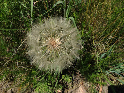
Grandelion!

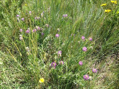
The trail along the mountain top was littered with small rocks.  I noticed small white quartz stones all along the trail, even when going down through the meadow.  The field atop the mesa was awash in blooms with almost every flower present blooming.  Orange Indian Paintbrush, white Yucca, yellow cactus, reds, purples, whites and yellows of every imaginable shade.  A botanist's dream.

Back of the top of mountain trail sign
Crossing through the old fence
Hiking down the mountain
I circled Lincoln Mesa and turned back downhill, passing through the old fence posts.  Once at the bottom, I turned to the Palmer Divide Ranch Trail, but gave up when I noticed the time.  I'll hike this trail soon.

Bench at Dewey's Hill on the Palmer Divide Ranch Trail Loop
To get there, follow CO 83 south 18 miles from Franktown.  Turn right on Jones Road, County Road 80, follow the gravel road to cross West Cherry Creek and take the second right into the parking lot. The approach trail runs .2 miles to where it splits for Lincoln Mountain and Palmer Divide Ranch loops.  Bring your drinking water, wear sunscreen and insect repellent.

Friday, July 10, 2015

Road Trip - Georgetown, CO

Hamill House Georgetown, CO
Road Trips are a fun way to spend the day, especially with your spouse, driving into the front range mountain communities and touring them.  I take occasional road trips and think just about everyone should get out and drive into a small town and take the time to look into their history.
Georgetown, Colorado was our goal for today, elevation 8530.  Georgetown began back in 1859, as a mining camp at a wide spot in the valley where silver had been found.  The first discovery of silver in Colorado was found by James Huff on September 14, 1864 about 8 miles from town near Argentine Pass.
The railroad came to town in the 1870's, and ran twice daily on the 52 miles of track to Denver, a trip costing $3.45. The town's population grew to over 10,000 people before the Sherman Silver Act was repealed in 1893. Of course most of the mines shut down and people left the area then, looking for riches elsewhere. It was in the 1950's when the town began to grow again as a watering hole for the high country skiers, returning home after a fine day on the slopes.
It was 15 degrees cooler than it was in Denver today and was raining off and on during our visit with overcast skies.  On previous trips to Georgetown, we had ridden the Georgetown Loop Railroad, had driven over Guanella Pass to Grant and had visited the shops and walked the streets.  Of the many things to see and do in Georgetown, we had missed touring the Hamill House and the historic Hotel de Paris.

Open yard showing Hamill House conservatory, fountain, office and barn on site
The Hamill House built in 1867 for the family of Joseph Watson.  Watson's brother-in-law William Arthur Hamill acquired the house in 1874 and by 1878 had acquired a fortune which he turned back into the house.  A new wing, conservatory, gas lighting, central heating and running water.  His office outside is where the mine workers were paid.  The tour was nice to see how the house was laid out, the conservatory was a welcome addition for the wealthy people of the late 1800's and the upstairs bedrooms looked a lot like other houses of the age.  I highly recommend the Hamill house tour.

Hotel de Paris
From there we toured the Louis DuPuy Hotel de France.  Mr. DuPuy created a fine high society hotel, with a fine French restaurant where he offered exquisite service to his customers and a showroom fro traveling salespeople.  His story before he came to Georgetown was very interesting. My favorite part of the tour is the kitchen, how progressive and thoughtful the design was.  Again, this historic site tour is highly recommended!

Old Silver Plume Jail
From Georgetown, we traveled west one exit to Silver Plume and drove the back streets and neighborhood.  My apologies to the residents, but Silver Plume looks like it is on the way to being a ghost town again with the fact that some businesses that were open last year now closed.  I did like the old jail and the Historic School.  We passed on the Old School tour for time (and rain) and drove back east on I-70.

Just so you know...
Idaho Springs was our next stop on the Road Trip, where we toured the neighborhoods and the welcome center.  Gold was first discovered here in January 1859 George Andrew Jackson discovered gold while camping on a sandbar at the confluence of Chicago and Clear Creeks.  This event launched the Colorado Gold Rush the next spring and made many people wealthy beyond imagination.  The welcome center east of downtown is worth a stop to see mining exhibits and displays of old stuff. Tommy Knocker beer is brewed downtown and if you like fine local breweries, you will need to stop here for a sample.  The Victorian houses here are awesome!  Around the town you can see three of the original fire station hose house buildings where the hoses were stored in preparation for a fire.  There was a lot of activity here, though the streets were sometimes very steep with houses seemingly built on top of each other.  The Argo Mine and its tunnel through the mountain to Central City is on our list to visit next time as we ran out of time for the day.  All in all, a great day and a great  Road Trip!
From Denver, drive I-70 west and up into the mountains.  Exit 228 is where you leave the Interstat for Georgetown, turn left under the overpass and right into the welcome center.


Friday, July 3, 2015

Spruce Mountain - Eagle Pass Trail

Columbine - Colorado's State Flower
My early Father's Day hike was on the Eagle Pass Trail at the Spruce Mountain Open Space area south of Larkspur in Douglas County.  The weather was humid for Colorado, with the views washed out by the moisture in the air.  It actually looked like I was hiking in the Smokey Mountains today, not the Rocky Mountains!
I walked for 5.4 miles round trip mostly through the meadow and some forest area.  The start was at the Spruce Mountain trailhead and I walked along the trail without climbing Spruce Mountain by continuing straight instead of turning left.  My goal today was to reach what I was told was a pioneer grave at the end of the trail.  My previous trip to Spruce Mountain is HERE.

Looking back east at the beginning of the trail across to Greenland
The Eagle Pass Trail sign, with the Eagle Mountain Conservation Easement in the background
Closeup of a weathered fence post, note the red flowers in the grass to the right
The trail passes mostly through meadow but also goes in and out of trees along the base of Spruce Mountain.  The pass is the high space between Spruce Mountain and Eagle Mountain.  Though not quite like a "pass" in the mountains at high elevation, it was still the saddle between the two high points along the prairie against the Front Range of the Rockies.

Wildflowers to the left side of the trail near the top of the pass
The view north of Eagle Mountain
The summer wildflowers were out everywhere alongside the trail.  I even saw Columbine, Colorado's state flower growing in the shade of the scrub oaks.  I have only seen this flower growing in the wild twice in the years I lived in Colorado, so it was a little exciting for me.

Columbine
More wildflowers
And more wildflowers
The "red" in the prairie grass
I continued along the trail enjoying the flowers, the view and the easterly breeze.  The sky was hazy, not a normal condition in Colorado, and the mountain views were washed out.  I only passed a couple hikers and mountain bikers and we all exchanged smiles with quick greetings and continued along. After almost an hour I reached the service road that connects to the trail around the top of Spruce Mountain.

In and out of the trees just past the top of the pass
Downhill into the trees
The view north across the prairie and surrounding farms
Sometimes the grass alongside the trail was almost up to my waist
A sign with the word "Steep" on it in Colorado means a vertical wall
Highway 105 or Perry Park Road, a favorite bicycling route of mine through the park-like valley
When I reached the service road, I turned to the right and followed it downhill a few yards to the next turn off to the right.  I followed that across a field and downhill to cross the dam of a pond, then switched back uphill to a ridge top.  From here I could see Highway 105 and hear the cars.  There were two picnic tables and some benches with a sign pointing the way to a pioneer grave site.  I followed the trail downhill to the overgrown site.  It has been fenced, but the weeds were too high to note any stones or markings.  I did not disturb the grave, but respectfully stayed outside the fenced area.  Maybe a trip to the Douglas County Library's history center will shed some light on who is buried here and when that happened.  A deer watched me from behind some trees.  It was very quiet here. I sat at a picnic table and drank some water, then headed back uphill on my return trip.

Ridge top picnic area
Temporary sign, poor iphone focus
Fenced Pioneer Grave site, an thoughtful Eagle Scout project
Watched by a deer
Turnaround point for the day
The return hike was as peaceful as the way in was.  The open space to the north provided quiet and once past the service road, I could hear no traffic until I was approaching the trailhead.  A hawk flew above and warblers flitted among the scrub oaks and pines.  I only met a couple mountain bikers once past the old service road and a couple hikers near the trailhead.  The sky had darkened a little but there was no rain or thunder along the trail.

That is the Eagle Pass at the break between the trees as seen while descending the ridge
Another temporary sign where the Eagle Pass trail leaves the Service Road
At the meadow shortcut trail on the way back
Meadow shortcut trail view
Finding Spruce Mountain Open Space trailhead is quite easy.  Go south from Denver on I-25 and exit at #173 Larkspur.  Please watch your speed driving through town as they are serious about you driving 25 MPH.  Travel south 6 miles on Spruce Mountain Road.  The trailhead is one mile on the right past Noe Road.  Pets are welcome but must be on a leash.  The trail is open from one hour before sunrise to one hour after sunset.  No camping is allowed.