Friday, June 26, 2015

Bicycling Local History

One of my favorite signs
I usually don't write about my weekly bicycle rides because they are usually just simple, local rides, mostly taken for my health and well-being.  Today's ride though includes some local history and I always like to talk about history.
My 25 mile ride started on top of the mesa, east and above Castle Rock.  I rode south along Ridge Road for 5 miles, then turned back north on Lake Gulch road and mostly coasted downhill (steep) and along the open hills and fields to Castle Rock.
My bicycle is recycled; a 1990's-era REI Novara XR.  It is a flat bar hybrid with 700 X 38 tires.  I changed the adjustable stem and handlebar, replaced the worn-out suspension seat post with a fixed one, and added an old rear rack.  Adjusting the derailleurs and brakes was fairly easy.  The tires are good and I changed to another saddle.  The bike fits me just fine and is working as a "paved & gravel road touring bike" for me.  I prefer to live like what I believe, and I do believe in recycling, renewing and reusing.  That's why I also volunteer at Project Recycle in Castle Rock where we recycle children's bicycles and then give them to waiting and happy riders.
Back in Castle Rock, Lake Gulch turns into Gilbert Street.  About 2 blocks onto Gilbert, I turned left onto the Sellars Gulch bicycle trail.  This trail follows Sellars Gulch to where it flows into Plum Creek, where the town of Castle Rock was founded.  Here the trail follows the Greenway alongside ball parks and soccer fields to the Douglas County Fairgrounds. You cross Sellars Gulch on a bridge and follow downhill, under the railroad bridge to cross under Perry Street at Festival Park near downtown. Continuing downhill through the riparian area, I crossed under Wilcox Street and went left onto the Plum Creek Trail.
This area inclines uphill beside Plum Creek and follows to the end of the trail across from the Safeway grocery store.  The area here is restored habitat for the Preble's Meadow Jumping Mouse, a local endangered nocturnal rodent living along the front range.   I turned around here and rode back north with the intent to follow the Plum Creek Trail to the end at the Meadows development.
At the Sellars Creek junction, I turned left and followed the stream-side trail to where it joined with Plum Creek.  The Interstate 25 bridge is right at this stream junction.  The trail goes under the Interstate, then goes north alongside the stream in the open land by the highway.  The Interstate noise is loud with the passing cars and trucks.  The trail crosses Plum Creek again and climbs a bit on the higher west bank.  Signs here explain Preble's Meadow Mouse and how beavers were reintroduced here to help manage the stream.  Soon you climb to cross under the Wolfensberger Bridge alongside hand painted signs for Project Recycle along the retaining wall.

???
Passing the businesses alongside the Interstate, you turn away from the highway noise and drop into a low area alongside Plum Creek.  There on the left side of the trail are long cement beams with bent steel at the ends with trees growing up between them.  This begins the historic portion of the ride.  A sign here says "June 16th, 1965, after several days of heavy rainfall, raging floodwaters along East Plum Creek tore through the town of Castle Rock."  Apparently, a tornado had touched down at Palmer Lake, and another at Dawson Butte with the downpours flooding the already soaked ground. The sign goes on to explain the floods affected Denver, then Kansas and Nebraska.  Cars, homes, churches, roads, rail lines and bridges were destroyed.  Tons of mud and debris were left behind.
This event claimed the lives of 21 people and caused $504.4 million dollars in damage. Adjusting for inflation brings that total to $3.8 billion dollars in today's money (in 2014's Estes Park, Lyons and Boulder floods caused $1 billion dollars damage).  The photos of wreckage on the sign showed pretty severe damage. President Lyndon Johnson declared the area a disaster area.  The sign also explains the long cement beams above were the deck of the Wofensberger Road Bridge.  It had been torn from its supports and washed half a mile downstream to where it sits today.  Since it was the only bridge at the time connecting Castle Rock's east and wet sides, this was a serious issue.  Including the Wilcox Street bridge and the Titan Road Bridge (north of Sedalia) there was no bridge access left across Plum Creek at the time. More information about the flood is HERE and ALSO HERE.

The sign explains it all
This spring, the Historic Douglas County group put on an event in Castle Rock to talk about the 1965 Flood at the Phillip S. Miller Library in town.  They explained the background material about the weather and storms, and invited community members who were living here at the time to talk about the flood in detail.
As the flooding began, a disaster drill was already underway at the new Douglas County High School which placed emergency personnel on the spot as the event happened. Of the 21 persons who died on account of the flood statewide, only one was a Douglas County resident who was drowned when her car stalled on a bridge that was washed away. Black and white photos documented Sedalia's Presbyterian Church being destroyed and washed downstream at the confluence of east and west Plum Creek.  Ariel photos that were taken by the military helicopters providing rescue showed the extent of highway wreckage in Castle Rock.  We watched a video of an 8mm film of the flooding taken by a Castle Rock resident, and viewed a slideshow of photos showing the flooding and the destruction.  I-25 was in use then and the Interstate's Plum Creek bridge was washed out.  Sellars Gulch also overflowed during the flood, taking some buildings and trailers with it.
Community members spoke of how dirt was piled up in the creek beds for cars to drive on until the bridges were repaired.  Stories were told about people using their horses to get back and forth across the creek after the water went down.  Telephones were out for 4-5 days and groceries were hard to come by for a couple weeks.
During the flood, peak discharge on the Platte River (where Plum Creek flows into) at Denver was 40,300 cubic feet per second.  At Castle Rock, the high water flow rate was 126,000 cubic feet per second.  It was reported that a wall of water flowed north that was up to 3 miles wide and over 10 feet high.  With today's increased population in the area, the negative effects of the flood would have been much greater.

From the Library Meeting, a helicopter shot of Castle Rock from the north east showing the bridge and highway damage
Community members at the Library meeting who were living here at the time of the 1965 flood
Bicycling north along the side of Plum Creek, there were sounds of children splashing and playing in the water. People walked their dogs, rode their bicycles, or just walked.  The area here is open and wide for a couple miles, passing Hangman's Gulch Trail at an open field.  Later the trail crosses the creek and passes under trees in a beautiful riparian area.  Beaver sign is prevalent, with trees cut and logs laying alongside the stream.  I wrote about this portion of the trail HERE.
Passing under Meadows Parkway Bridge and saluting the painted silhouettes of soldiers, the trail continues north, eventually climbing above Plum Creek.  From the high ground I spot a couple of old cars by the creek, perhaps more damage from the 1965 flood, or perhaps just junked old cars.  The view to the northeast is of construction cranes building the new Castle Rock Parkway bridge at US-85 with Castle Pines in the background.
Here the trail turns more west, surrounding a drainage and turning under the railroad tracks through a stone bridge. Immediately after the tracks, you go under another modern cement bridge to Castle View High School, and ascend the hill to cross under Meadows Parkway.  Stopping at a trail intersection beside a park, I found myself across the street from housing construction.  My odometer showed I had bicycled about 5.5 miles from the other end of the Plum Creek Trail.  I turned around and rode back to town along the Plum Creek Trail, pausing under the I-25 bridge during the rain, then putting on my raincoat and riding in the continuing rain.  At the ball parks along the Sellars Creek Trail, I rested under a shelter until the rain stopped enough to ride again.
Here I turned right on Gilbert Street and rode to Plum Creek Parkway.  Turning left I geared down to my granny gears and climbed the hill along the wide sidewalk back up to Ridge Road.  I actually used my 34 tooth ultra-low rear cog on the hill in a couple of the steep places.  Once I had spun up to the top at Ridge Road, the sky opened up again and I put on my raincoat.  It rained the rest of the ride back to my car. I cut my planned 30 mile ride short to get out of the rain and finished at 25 miles on my odometer.
To start this ride, exit I-25 at highway 85, exit 184.  Turn left and follow Founders Parkway almost 5 miles to the traffic light at highway 86/5th Street.  Go through the light and turn left into the King Soopers parking lot and park.  Bicycle to the left and follow the sidewalk along Ridge Road to follow the route.  When the sidewalk runs out, take the road and follow Ridge Road south.
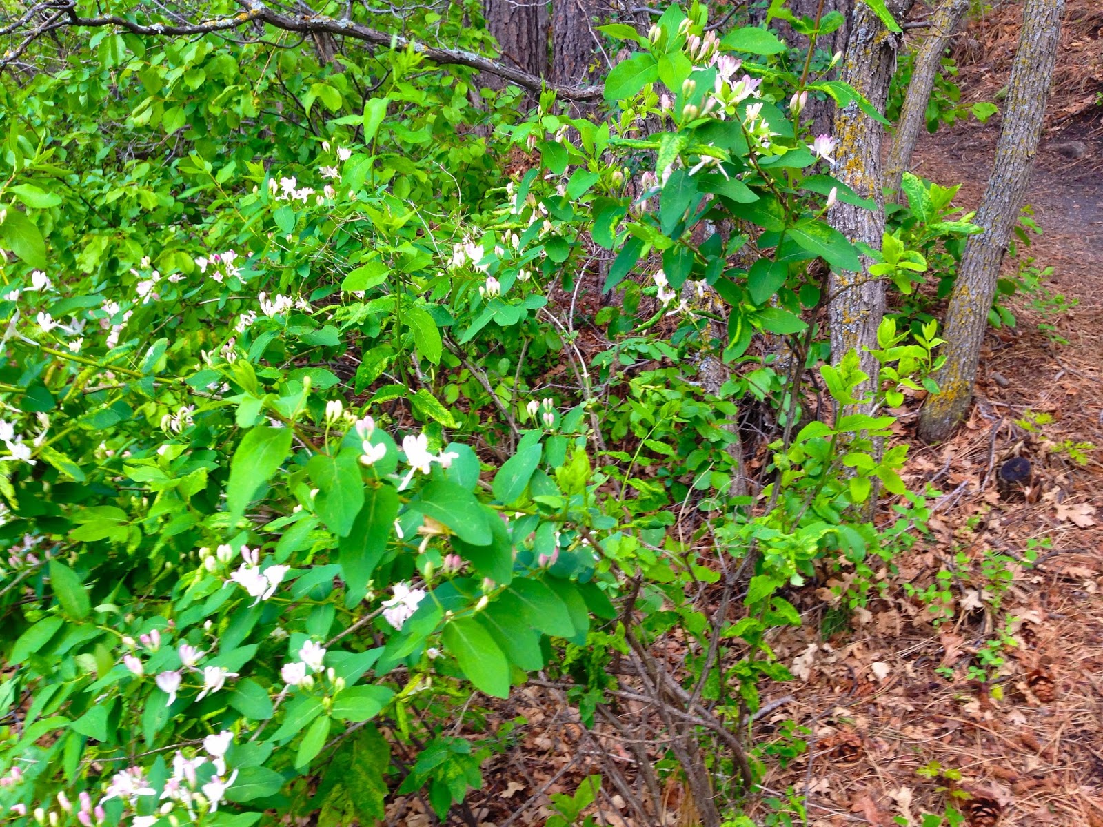
To get an additional 5 miles for a total of a 30 mile ride, when you climb back up to Ridge Road, turn right, then turn left onto Appleton Way, then right onto Lantern Circle and follow to where the Mitchell Creek Canyon trail crosses the street.  There is a disc golf course here.  Turn left onto the trail and follow it to cross Michelson Blvd. and continue along the trail to the next right turn.  Take this right turn and cross the field with a dry stream bed to your right.  Cross Michelson again and continue to follow the trail down into the canyon. The canyon area is a peaceful area and if you stop at a bench you can listen to and watch birds flit through the trees.  Climb out of the canyon, then turn right on Enderud Blvd.  Go a couple blocks to turn left onto Heritage Avenue.  Follow Heritage past Rock Ridge Elementary to Enderud Blvd., turn right and then go right onto the sidewalk at Ridge Road to get back to your car.

Friday, June 19, 2015

Walking Dinosaur Ridge

Dinosaur footprint at Dinosaur Ridge
My wife and I visited Dinosaur Ridge in Denver for a day and we had a beautiful afternoon.  Rain (again) was threatening, but we just got damp this time.  The last time we visited the site with our children, we just drove up the hill and stopped by the Dinosaur tracks to look.  This time the road is closed to cars, is painted with lanes for bicyclists and pedestrians, and we were the pedestrians.  It is now called the Dino Trail.

Visitor at the footprints area
Medium shot of the Dinosaur Tracks, colored with charcoal to stand out
Wider view of the tracks
The site now has signs and markers, plus areas set alongside the rock to view the footprints, shale and the layers of sea floor with ripples.  There are 15 sites along the 2 mile trail, all with signage.  Signs explain the Morrison Foundation of sediment and what Colorado looked like then, when the land was under a shallow sea.  I only covered a few of the sites in this blog, go online to read more.
The site was first discovered during road construction in 1937 and was left open to the weather (and unfortunately, vandals) 52 years until the Friends of Dinosaur Ridge were formed.  The area is now designated as a National Natural Landmark by the National Park Service, a State of Colorado Natural Area, and is recommended by the Colorado Geologic Survey as an official Point of Geologic Interest.
Top of the ridge, note the round "occlusion" in the rock strata
Near the bottom of the other side of the ridge is the dinosaur bone quarry, encased in stone.  This site was first identified in 1877.  The world's first Stegosaurus was found at site #5 near here.  The bones petrified in the rock were apparently washed here during a flood into a pile.  This is one of the few places world-wide where you can actually touch the fossilized remains of a dinosaur.

Touch the bones here
The rain started (again) as we walked back toward our car.  It has rained so often this year, with occasional hail and lots of wind.  Yes we need the rain, but we don't need flooding and hail damage. Hopefully the weather will calm as summer approaches so we can all get outside.

Mule deer on the return trip don't mind the rain

Bicycles left, pedestrians right.  An easy 2 mile walk.
To find Dinosaur Ridge, follow I-70 west of Denver.  Exit south on CO-470.  Exit at West Alameda Parkway.  Dinosaur Ridge signs point the way.  Turn right and then take a quick right into the visitor center, or dive forward and to the left, parking along the roadside at the barriers.  I highly recommend visiting here.

Friday, June 12, 2015

Day Trip to Golden Gate Canyon State Park


View from Panorama Point
My wife and I drove to Golden Gate Canyon State Park for a day trip and had the most wonderful time! I had written about hiking here back in March HERE.  Getting there was half the fun.  We drove north on I-25 from Castle Rock, taking CO-470 west and following it to US 6, where we exited at Golden.  We drove north on CO-93 through Golden and turned left onto Golden Gate Canyon Road right next to Mt. Galbraith Park which we followed almost 30 miles to the visitor center in the park.  The visitor center staff were friendly and very helpful in helping us plan our day.

Looking Northeast to Starr Peak from Gap Road
Looking Southwest from Panorama Point toward Mount Evans
From there we turned right and followed CO-46 a few miles to turn right at Kriley Pond onto Mountain Base Road, a narrow, steep, winding meander through the park.  Here is where it became interesting with pull-out after pull-out, picnic areas, trailheads, and views upon more views and even more views.  We climbed uphill by Promontory Ridge.  The pine and aspen trees, 10,200 foot Tremont Mountain looming above us, the rocks and grasses, the sneak peeks of mountains in the distance, all were very scenic. This road is so narrow, twisting, steep and winding that RV's, motor homes and over-sized vehicles are not allowed. The grades reach 19% along the narrow switchbacks. An alternate route is to follow CO-46 from the welcome center to CO-119, turn right and then turn right again at Gap Road to reach the Reverend's Ridge Campground, Panorama Point and other Gap Road sites.

Panorama Point views go on forever
More views...
When we reached Gap Road, we turned right to get to Panorama Point, and what a view. Rocky Mountain Peaks from Mount Evans to Arapaho Peak to Longs Peak filled the sky with many more mountains between them.  A free viewer brought the mountains closer and signs along the viewing deck showed us where Rollins Pass was and what mountains we were looking at.  I took lots of photos, but the clouds had already come in so they don't look as beautiful as we were seeing them.


Thorodin Mountain just north of Gap Road
Pinnacle above the Harmsen Ranch
From Panorama Point, we drove east along Gap Road (gravel) to the Harmsen Ranch Guest House and outbuildings.  You could tell this was a working ranch at one time and the guest house can be rented nightly.  This used to be the home of the family who started the Jolly Rancher candy company.
East along Gap Road on the right was Aspen Meadow Campground with 2 loops for tents, pit toilets and lots of aspen trees.  It backs up to a meadow and seems very peaceful, especially the last 2 sites. There is a trailhead here for the 3 mile Snowshoe Hare Trail.

Along the Buffalo Trail next to Nott Creek
Once someones home, now an unmarked Historical Structure
Looking back uphill on the Buffalo Trail
Back to Gap Road and the next campsite on the right is Rifleman Phillips Group Campground.  A group was camped there, but they were not at the site when we were hiking from the trailhead there. We followed the Buffalo Trail which parallels Nott Creek on its journey downhill and southeast which lead toward Forgotten Valley.  Rainy weather turned us back to the car but we did get to see some Historical Structures and turned around at the Gilpin/Jefferson county line.

Our next trail from the Reverend's Ridge Campground, Raccoon
Nicely marked, moderate Raccoon hiking trail to Panorama Point
We then drove back west along Gap Road to Reverend's Ridge Campground.  What a nice campsite and how well it is setup with coin showers, flush toilets, laundry, yurts and cabins.  There are full electric RV sites, tent sites and another welcome center.  No wonder this place is all about camping! While there were only a few brave souls camping when we were there, the campground was full when we checked on the following Tuesday after the weather warmed up.  The Raccoon Trailhead in the campground runs about 2.2 miles to Panorama Point and back, which we partly hiked.

More Raccoon Trail on the return trip
Interesting tree cut, where 2 small trees grew together, creating a third set of tree rings
As we left the campground area, we found a Gilpin County Library a few miles south on CO-119 with wireless Internet access, another public campground, gas and a store, all very convenient.
Alternately, you could follow Gap Road and Twin Spruce Road east to Coal Creek Canyon road where there are stores and coffee.
Our return trip was Gap Road west to go south on CO-119 through Blackhawk.  Outside of Blackhawk we took US-6 to the right through Clear Creek Canyon and Johnson Gulch back to I-70, then followed the Interstate back east to Denver, then south on CO-470 and south on US-85 to Castle Rock.  What a great day trip!

Saturday, June 6, 2015

High Prairie Spring at Memmen Ridge Open Space

Ponderosa Pine along Memmen Ridge Open Space Trail
If it could bloom it was in bloom on the 43 acres of the Memmen Ridge Open Space in Castle Rock. The sun was out for the first spring afternoon in weeks with no rain and life was proudly announcing itself to the blue skies.  The Memmen Ridge Open Space is in the southern portion of Castle Rock and runs adjacent to near-downtown neighborhoods.


 A popular local 5K fitness route runs through Memmen Ridge and has about 120' of elevation gain along the path.  The area is popular with runners, walkers, mountain bikers and dog walkers.
27% of Castle Rock's land area is devoted to parks, trails and open spaces like this with a total of 56 miles of both natural surface and paved trails within the town limits.  It is nice to be able to walk or bicycle so near your home.


The short 1.9 mile hike runs from the willows in the riparian area near the stream through meadows up to a mature ponderosa pine forest on the north ridge, and takes about 50 minutes to circumnavigate on the hiking trail.  A cross trail can provide plenty of exploring with a bench or two at specific sites.  This was a great break from the town and was a surprisingly good hike.  It would make a moderate-difficulty mountain bike ride too.


It was a very peaceful hike, with red-headed warblers and Colorado bluebirds flitting among the oak scrub, grasshoppers springing up from the dirt trail in front of me and the low sound of wind in the trees.  The smell of the pines was strong, the meadow air was fresh as just washed, and the varied blossoms of cactus, Indian paintbrush and bluebells colored the scene.  From the ridge you could see over the town to the front range in the west.


How to find Memmen Ridge Open Space: From the Castle Rock/Highway 86 exit 182 on I-25, travel south on Wilcox Street to 5th Street (Highway 86) and make a left turn.  Go 5 blocks and turn right on Gilbert Street.  At the stop sign at South Street, turn left and then take your first right onto S. Oman Road.  Make a quick left into the trailhead parking lot.  A trail map is available HERE.

Friday, June 5, 2015

National Trails Day


In case you didn't know, this Saturday, June 6 is National Trails Day.
Get out and Hike!!!
Here are descriptions of 10 of the new 150 trails in the National Park system.  Try them out!