Friday, April 24, 2015

Campsite Selection

Campsite Selection

Meadow view
Golden Gate Canyon State Park Meadow view
This is another article I wrote for CampHelp.net.  The site will be up soon.
Selecting a campsite for your tent or trailer is pretty easy to remember.  When you arrive, my advice is to Look Up, Look Down, and Look All Around:
Look Up – I always look at the trees around the campsite, checking for dead limbs or branches, a tree leaning into another one (dead fall) and at rocks and ledges that may be above me for stones that may tumble during a storm or in the night.  You want to make sure the area overhead and to the sides is clear of any dangers that may blow down on top of you in a storm.  Wind is often strong in the mountains and tonight may be the night when that limb decides it’s time to fall off that tree.
Look Down – Look at the lay of the land, specifically where water could flow during rain.  You don’t want to camp in a ditch or in a low point because it will be wetter and colder (cool air sinks).  Typically, a higher and more level point of land is best for tent or trailer.  Don’t camp too close to a cliff either, as you could be blown, washed (or just roll) off the ledge onto those shark teeth rocks below.   Do remove rocks and sharp sticks from under the tent for a comfortable night’s sleep and plan to return the area to the pristine natural surface you found as you leave.
Look All Around – Look around you for signs of trails as you don’t want to camp where wildlife or people could blast through unexpectedly.  Look for enough space to pitch your tent but don’t camp so close in dense trees that you have to cut anything to make your tent fit.  Try not to camp too close to your neighbor for your privacy and theirs.  Look for beautiful views and quiet spaces.  Also look for some trees or tall rocks to be around your site to help reduce winds.
While tent camping is usually associated with backpacking, it is not always the case.  This is where CaRV camping works well, with a flat and developed camping site, maybe even a pull-through parking space with plenty of clearance above, below and around.  The car can carry all your gear and food and gives you an escape to go try that little cafe you passed on the way in to enjoy a dinner instead of cooking one.  CaRV camping in a tent/trailer/RV at a State Park or National Forest is a great way to just get outdoors and enjoy the peace.

Friday, April 17, 2015

Hidden Mesa Trail - The Mesa Top

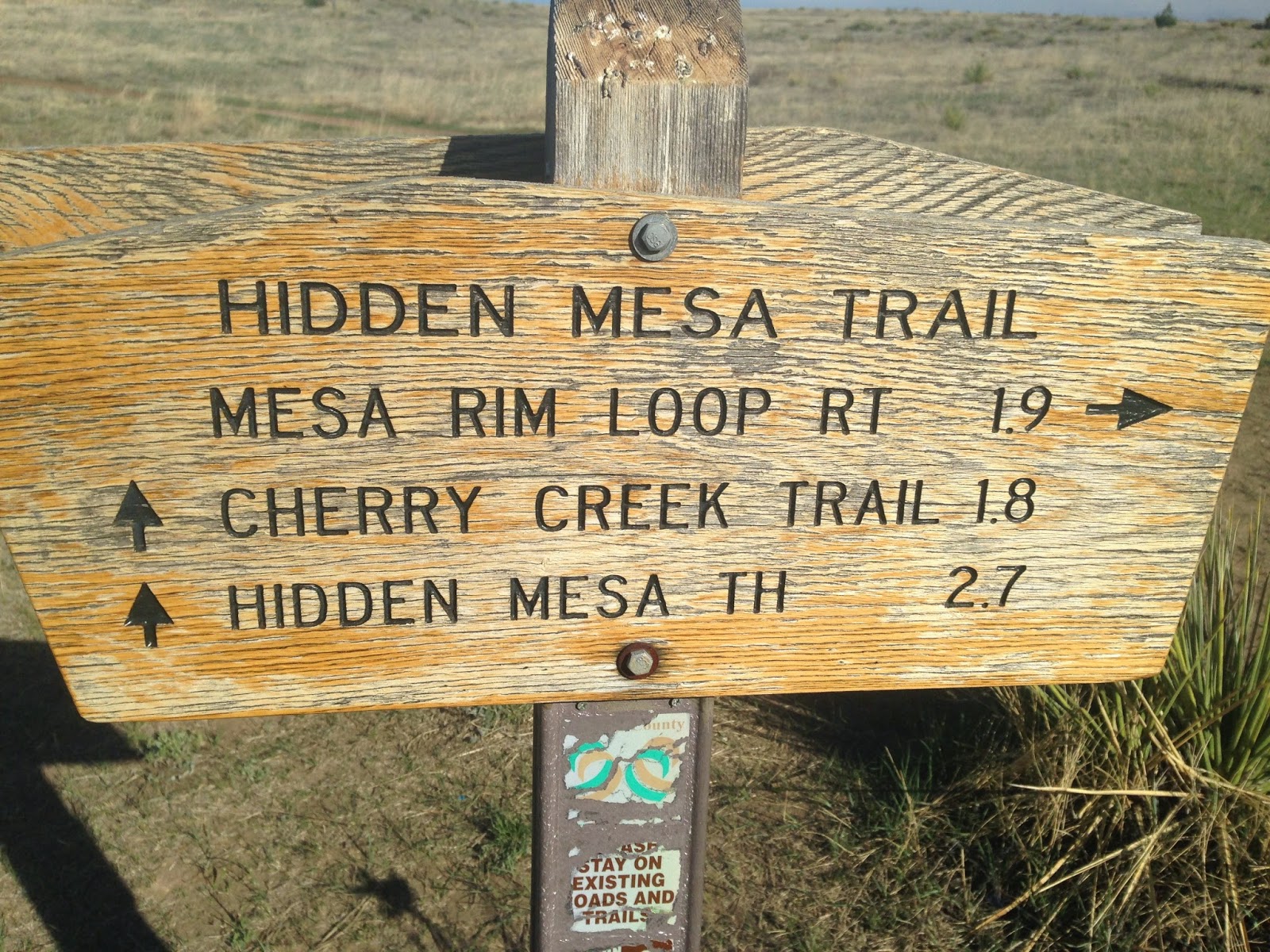
Top of the mesa trail sign
I hiked the Hidden Mesa Open Space Trail along the mesa top 3 times in the past 2 weeks because it is so QUIET. The 2 mile loop trail, just a third of a mile from the parking lot, is an easy, mostly flat hike with views in all 4 directions.  My wife joined me for each of these hikes.  A map is available at the link also.

Looking North East
The peacefulness is just plain inspiring.  Bird song was the second loudest noise I heard.  Prairie Dog warnings were the loudest noise by far.  Even the occasional whoosh of an airplane above was washed away by the wind and that wind was heard through the trees.
I last wrote about the Hidden Mesa Trail here, when I walked a portion of the lower trail off CO 83 at Franktown.  I still have to walk the trail from there up to the mesa top and will write about that when it happens.
Looking East
The trail is well marked
Most of the walk is in the sandy top soil of the mesa.  This sand is from the worn down crust of the top layer of Rhyolite, and is filled with quartz and black, brown and red river stones that came with the Rhyolite.  You can read about how this form of Rhyolite came to be here.

Rhyolite in its interesting hoodoos
As you travel counter-clockwise from the parking lot junction, you travel mostly on rock with short sandy areas in between.  Conifer trees sprout from the stone along the path and provide moments of shade and add sound to the wind whistling through them.  Oak scrub grows mostly from the soil and away from the cliff edge.  You can see highway 86 below you beyond the tumble of rocks and occasionally hear traffic on it.  The trail continues around the edge, then works back northerly onto the mesa center before running to the edge twice more.

Looking Southeast
Now on the eastern side of the mesa, the views are of Cherry Creek below, the farms and Franktown. Below is the 124 acre test farm, greenhouse and orchard next to the old family house of the original farm and acreage that Douglas County Open Space purchased as part of Hidden Mesa.  The picnic area and parking lot are next to that, with the farm lane winding down to cross Cherry Creek and then picking up the Cherry Creek Trail going north and south.  A couple benches up here provide views to the east and provide a break in your day.

Early spring flowers
A lot of old trash has washed on down the mesa to the right.  Behind the oak scrub there is an old refrigerator, a furnace and half an acre of rusting tin cans.  My hope is someday they will remove this trash, recycle what they can and bury the rest.  The mesa top deserves that.

Natural surface trail
Showing the route and distance to the Trailhead on CO 83 below
 The trail continues on, turning to the left before its junction with the trail to the farmland below. Prairie dogs squeak here, warning others of the danger.  It is fun to watch them run from hole to hole, pop up and down and suddenly go quiet when you get too close.  A couple holes are right next to the trail and I expect these prairie dogs are very busy sounding the alarm on weekends.

It is nice to have signs as nice as this one

Bench for relaxing
A mountain biker whizzes by after announcing his presence, then thanks us for stepping off the trail to let him pass.  Nice trail etiquette! This trail is quite popular with the mountain bikers.  It has some technical challenges mostly along the rock edges, and gives a good climb up the ridge, but it is not too technical for novice riders.  Plus it is close to Castle Rock, Franktown and Parker.

Rhyolite near the edge
Mostly in the open now, we look to the north and follow the view of the mountains of the front range until they fade in the distance.  We climb a hill and drop down a little to the parking lot trail by the bench.  Returning to the car is fairly quick, with just a short drop and a few turns along an old farm road.
More spring flowers
The gate here closes automatically at dark.  We sit and talk a while listening to the wind, and finally leave as another mountain biker pulls in.  It has been a peaceful afternoon.

Parking lot for Hidden Mesa
Getting here is easy.  Take I-25 south of Denver to exit 184 at Founders Parkway, then follow to the left through the stores 2 miles to the Terrain Subdivision on the east side of the road.  Turn left into the second entrance which is Rising Sun Drive, follow left through a roundabout to Autumn Sage Street, then turn left onto Castle Oaks Drive.  This takes you downhill by the remains of an old farm, and crosses a stream.  Then take the second gravel road right onto Pleasant View.  Follow this to the top where the parking area is, park and hike.  There is a Port-a-let at the end of the parking lot.

Friday, April 10, 2015

Lost? No Compass? No Worries!

Older style compass.
Lensatic compass
Forgot your compass?  Are you lost and without a compass and need to find the way home?
Here's an idea from our new project in the works, Camp Help.
While this may be a problem for most folks, if it is sunny at all you can find directions easily using the track of the sun across the sky.
Place a stick in the ground and mark where it creates a shadow.  Label this with a W.
Then wait 20 minutes or more. Sit and eat a snack.  Enjoy the view.
Now, place a mark at that new shadow and mark it with an E.
The first mark is to the west, the second mark is to the east.

Friday, April 3, 2015

Quarry Mesa Open Space

View from the top north towards Castle Rock
Long just another mesa at the south end of Castle Rock, Rhyolite was discovered at Quarry Mesa Open Space in 1872, creating Castle Rock's first Rhyolite Quarry.  Rhyolite was determined to be a great stone for building construction, and it was used to create Colorado's State Capital building, and many other historic buildings in Denver and Cheyenne.  The original Douglas County Courthouse, and many businesses and residences in Castle Rock were also built using it.

Looking back along the old RR grade up the east face of Quarry Mesa
Allocated after 2009 with help from Great Outdoors Colorado, the Open Space of Quarry Mesa offers 133 acres of views and wide-open space with 3.4 miles of native material trails, suitable for both hikers and mountain bikes.
This trail also connects to the Rhyolite Regional Park and the Rhyolite Bike Park just off Crystal Valley Parkway.  A Cyclocross course exists in the Rhyolite Bike Park at the mesa bottom.
The hike to the top up the old RR route was not too steep, and it winds around the north side giving an overview of the Cyclocross course below.  It was windy when we went and we were surprised at how large the area at the top really is.  It is easy to imagine how this looked before mining.  We even saw a bluebird when we returned to our car.

Following the road on top around the east side
Three trails lead to the mesa top, and a trail loops the mesa top along with an old road.  Views of Castle Rock and the front Range of the Rockies are excellent from here.  The trail around the edge is called Madge Trail for the rancher who founded the quarry, and it runs 3.4 miles.
Restrooms are available at Rhyolite Regional Park.
Please beware of rattlesnakes while using this trail.

Pikes peak in the distance to the south, next to a cairn
If you want to read more about how the 36.7 million year old Castle Rock Rhyolite was formed, read HERE.
A Quarry Mesa Trail Map is available HERE.
A link to Rhyolite Regional Park is HERE.

View of the grassland at the top of the mesa, this is huge!
To find these trails and parks, exit I-25 at Plum Creek.  Turn left and go to Wilcox Street, turning right at the light. Wilcox Street becomes Frontage Road, follow for 1.6 miles.  Turn left onto Crystal Valley Parkway and follow for 2.1 miles.  Turn left into the Rhyolite Regional Park and park, follow the paved trail back uphill along the road (a good ways) towards the native-surface trail system. Future plans show a parking area by the old railway grade next to the pedestrian bridge, which is the shortest way up.